MOUNT WASHINGTON
AT Day 121: Sunday, August 6, 2023
SOBO Mile 1883.8 – 1860
Wildcat A Mt – Mt Pierce
Distance Hiked – 23.4* miles/37.6 km
Total Distance Hiked:1983.4 miles/3191 km
A: 5285 ft / 1612 m D:2723 ft/830 m
It was a cold and windy night on Wildcat Mountains Ridge. It’s only just bit over 4,000 feet yet it felt really cold through the night. A day hiker yesterday commented that this weekend was the best weather they’ve had in New Hampshire, all summer.
We hope to reach Mt Washington today and consider what next as rain and thunderstorms are forecast for Monday to Thursday. It’s not just that it will be raining, much of the upcoming section of trail is over numerous 4K mountains and exposed ridgetops above the treeline. The alpine zone occurs at very low elevations.
Mt Washington feels like a huge hurdle we need to get over. It has a reputation for the worst weather in America. It is the second coldest location on earth and has it’s own weather patterns. Wind speeds of over 230 mph have been recorded on the mountain.
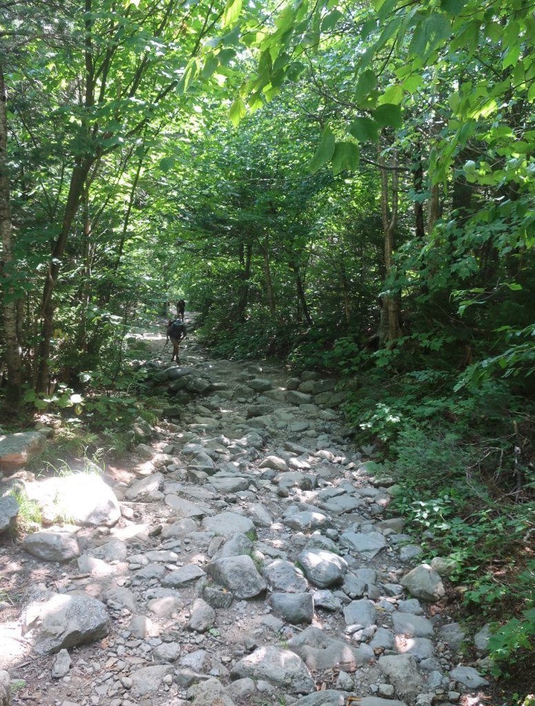
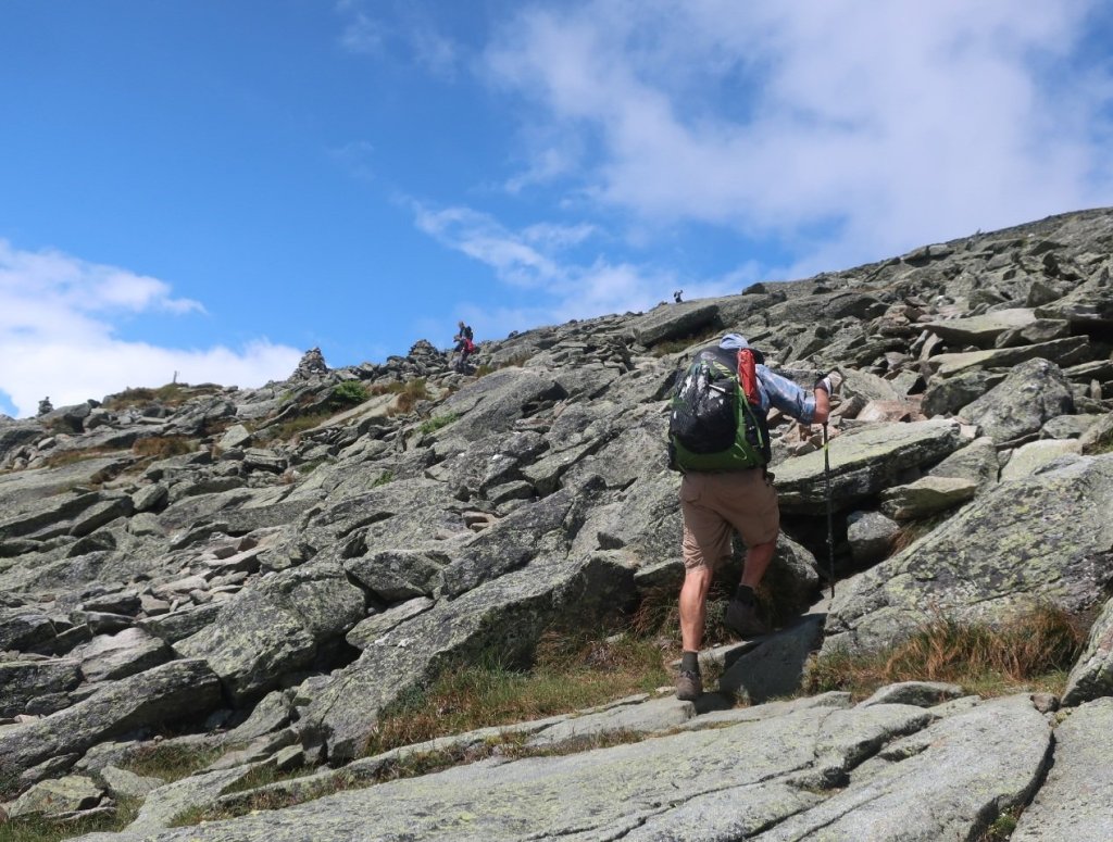
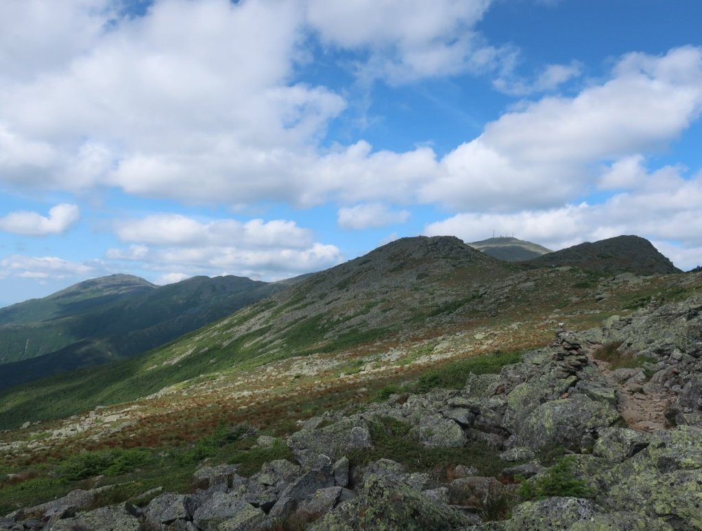
Clear skies and a beautiful sunrise greeted us as we set off at 6am. We went down and back up over a rocky scramble towards Wildcat D Mountain. It was slow going which was frustrating as the weather was absolutely glorious today. We would like to make better progress while the weather is so good. The best pace we can manage is a mile to mile and a half per hour on this terrain. And the threat of injury is ever present. My knee is hanging in there but I’m not happy about having to take pain meds just so I can keep hiking.


On the way over the Wildcat Mountains Ridge Hammer suggested taking the ski road near Wildcat D Mt down to Pinkhams Notch instead of the series of long rocky ledges which form the AT descent. Most hikers do this section of the AT from Gorham to Pinkhams Notch slackpacking northbound to Gorham, as it is easier to ascent the Notch. The ski road was a slightly longer descent but much easier on my knee. If felt nice to hike in the sunshine while descending. It’s incredible how much better we feel just by seeing the sun and sky. We passed groups of day hikers heading up to the Wildcat Mountain Ridge. The locals know the best route.
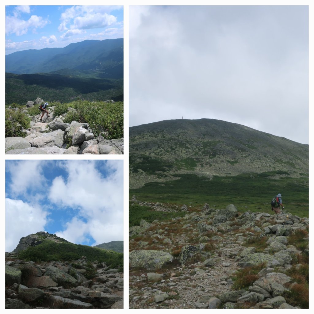
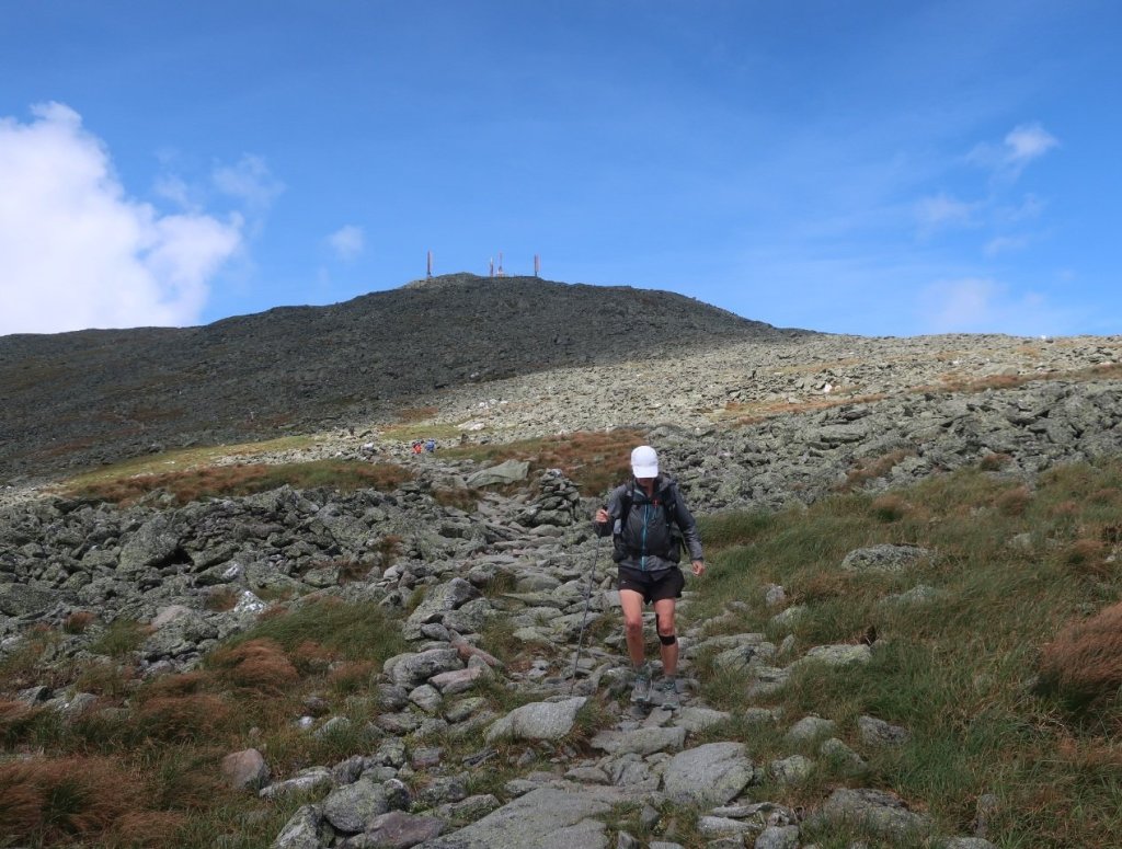
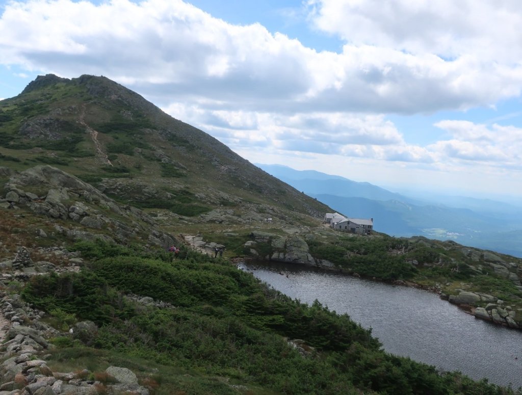
Arriving at Pinkhams Notch felt like a transition. The carpark was packed and day hikers were everywhere taking advantage of the great weather on a weekend. We went into the visitors centre hoping to get something to eat. Disappointed to find that no hot food was available until lunchtime due to a labour shortage. I spoke to the Ranger on duty about our options for shelter while hiking above the tree line in the next section of the AT and especially on Mt Washington. He advised us to hike Mt Washington today as the weather over the coming 2 to 3 days will make it risky. The most direct route to Mt Washington from Pinkhams Notch was on the Tuckermann Ravine/Lions Head trails. It rises over 5000 feet in 4.5 miles and bypasses Madison Mountain, the northernmost mountain in the Presidential Range.
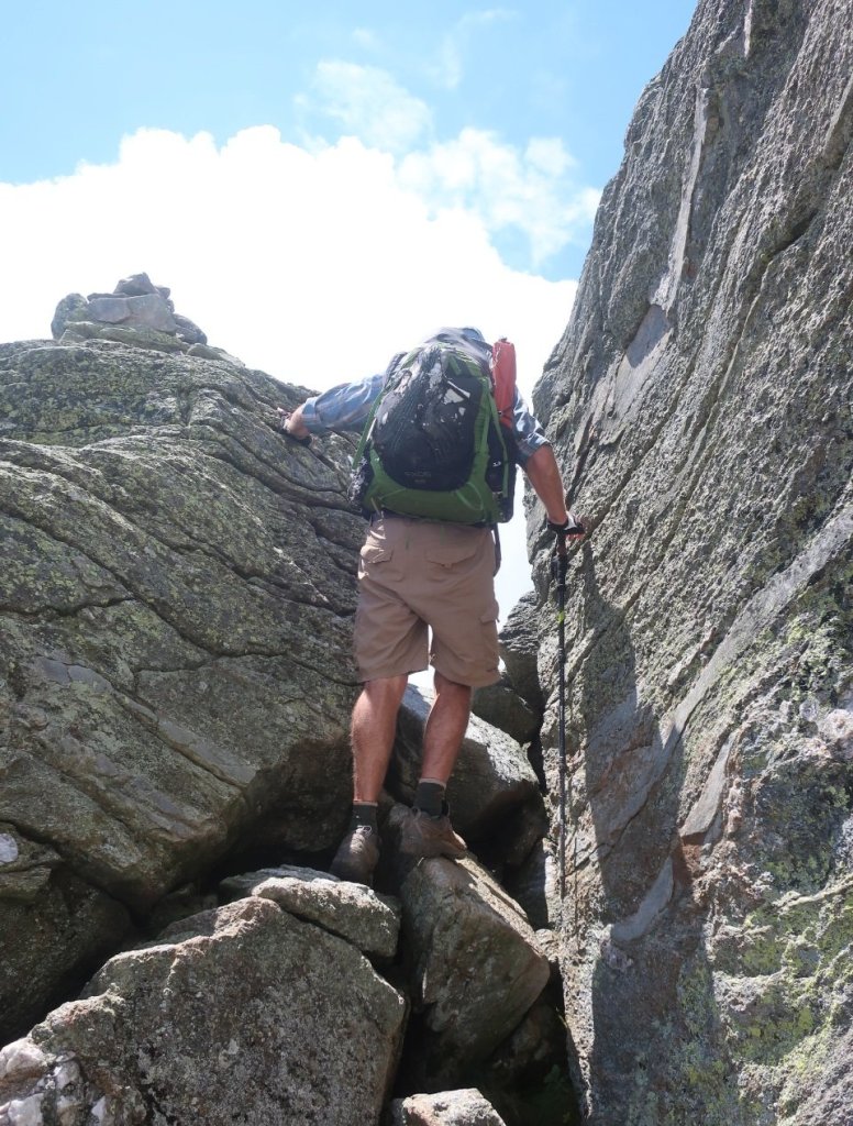
We took this advice and joined the day hikers heading up Mt Washington. The Tuckermann trail was wide, steep and rocky, Pennsylvania type rocky. A nice change from bouldering. But that came soon as we started up Lions Head trail. The wind got stronger as we got above the trees. And by the time we were on Lions Head the wind was scouring.


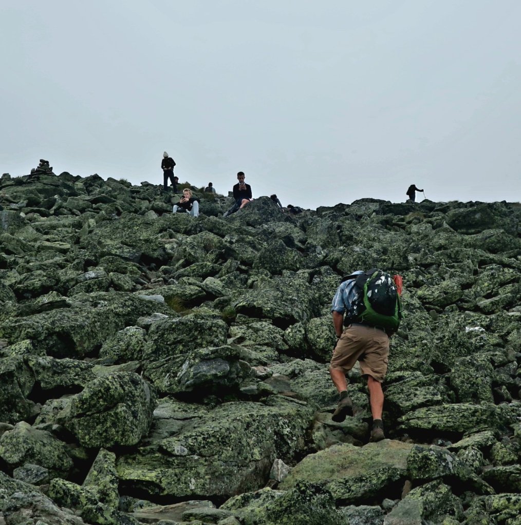

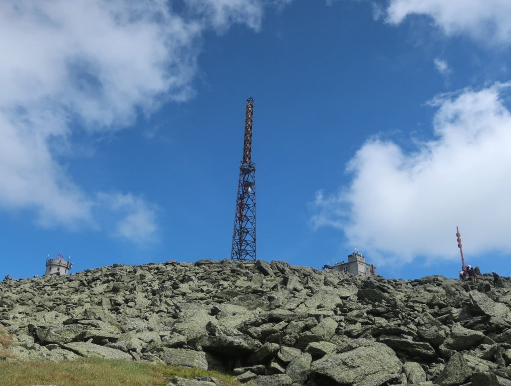
The climb took us close to 5 hours and we emerged into another world. It was super busy with cars, motorbikes and the cog railway delivering hundreds of visitors to the summit There was even a long line of people waiting to have their photo taken next to the Mt Washington sign. We bypassed the summit sign and took a photo next to a lesser Mt Washington sign.
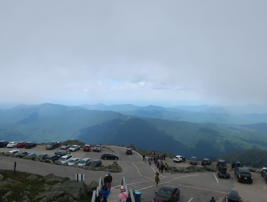
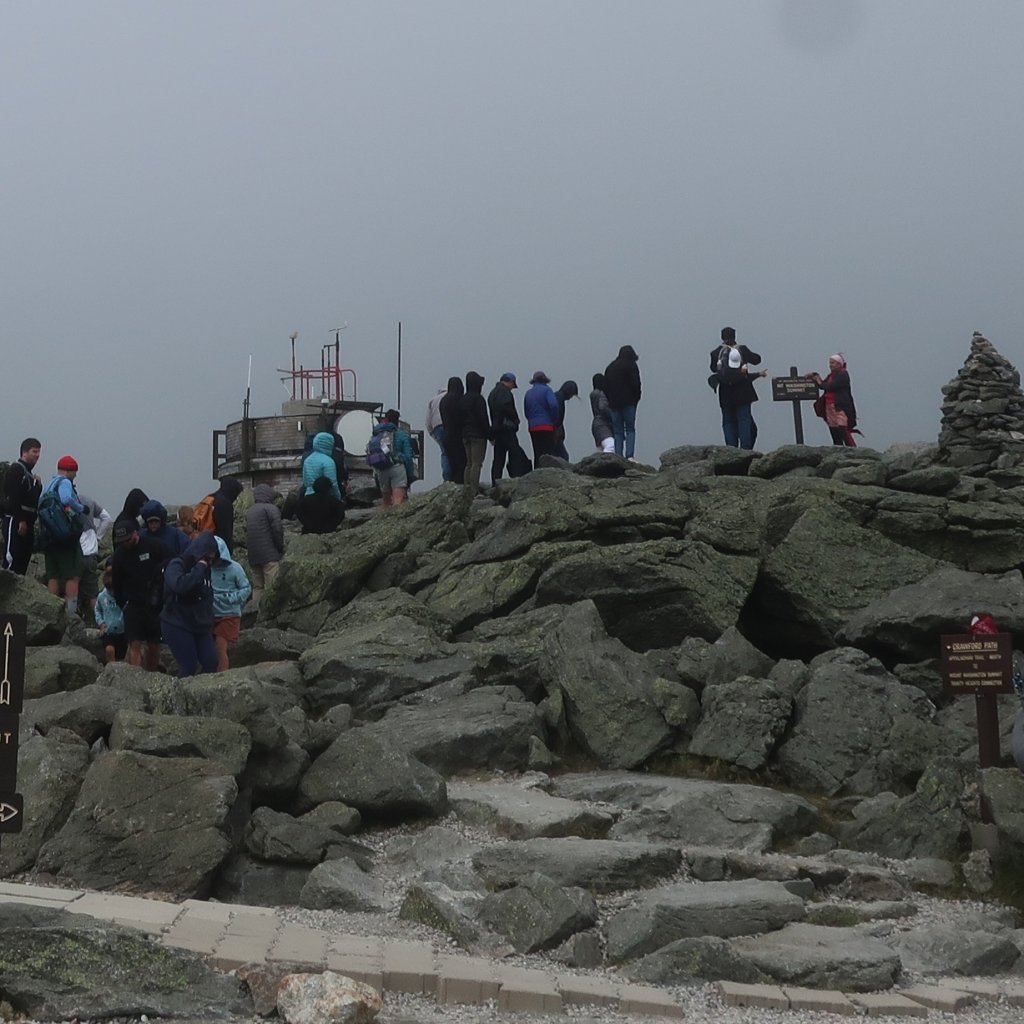

The wind was something else – strong and cold. Todays windchill on the mountain was around 34°F (1°C) and this is on a good day. The wind was so strong it made it hard to be outside on the summit. I can’t imagine how awful this summit would be on a bad day. We were feeling happy with our decision to take advantage of good weather and hike Mt Washington today. We got some hot food from the restaurant and sat downstairs in the quieter hiker section downstairs.
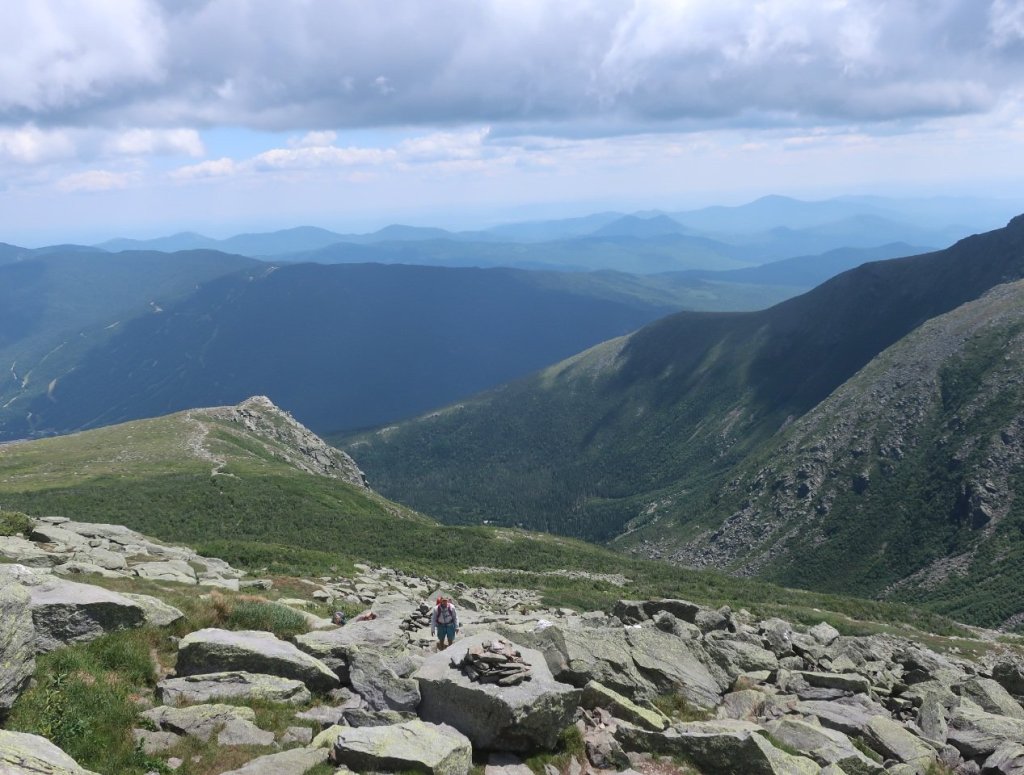
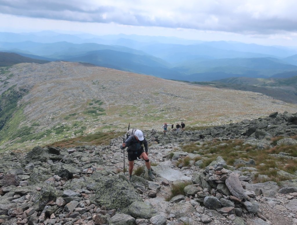
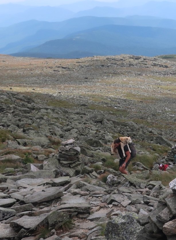
Feeling happy with got back outside and started the descent off the mountain on the Crawford Trail hoping to get off the exposed ridgeline and back into the woods before days end. The trail was rocky and not overly taxing, just cold and windy. We stopped for the day and camped amongst the trees on the summit of Pierce Mountain, a 4K summit and the southernmost peak of the Presidential Range.
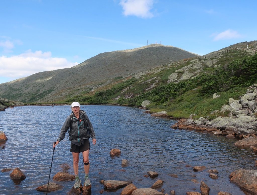


*We hiked the Tuckermann Ravine/Lions Head Trail from Pinkhams Notch to Mt Washington – which was around 8 miles less then the current AT route from Pinkhams Notch along the Old Jackson Road/Madison Gulf trails.
Mount Washington! Wow!
Memories. I bike raced up the 8 mile road many years ago. Really tough. Can’t imagine how hard to hike up. Glad you had clear weather.
Hope it stops raining soon
Paula
LikeLike
That’s hard core to cycle up the mountain Paula. Good luck in the World Champs.
We got lucky with the weather for Mt Washington.
LikeLike
Looks like a tough mountain to climb!
LikeLike
It was Anna. A real rock scramble towards the summit. And the wind was something else.
LikeLiked by 1 person
Happy you had a beautiful day on top of Mt Washington!
LikeLike
We were happy to have taken the rangers advice and sumitted Mt Washington on a fine day.
LikeLike