INTO NORTH WOODSTOCK
AT Day 123: Tuesday, August 8, 2023
SOBO Mile 1844 – 1825
Zeacliffs – North Woodstock
Distance Hiked – 19* miles/30.6km
Total Distance Hiked: 2018.4 miles/3200 km
Heavy rain pelted the tent all night. Hammer was so happy I convinced him to replace the old tent. We were lucky the tent did not get flooded as later in the morning while hiking along Zealand Ridge the few dispersed campspot we saw were submerged in a foot of water.
We waited for the sound of rain to ease a bit before breaking camp. It was miserable, white out conditions and rainfall got stronger just as we set off. We had three over 4K summits to go over before the trail drops off the ridge for a bit.

There was so much water on trail it felt like we were hiking through a creek. The trail was not overly difficult over Mt Zealand our first 4K summit. By the time we reached Mt Guyot the wind had picked up and the rain was coming sideways. The summit of Mt Guyot is in the alpine zone so it doesn’t have trees, so we were totally exposed to the scouring cold wind and rain. We hiked through here just following the rock cairns as nothing else was visible. It was a seriously awful traverse. I started to shiver as my wet weather gear was really not keeping me dry. My clothes were soaked to the skin. Hammer fared a little bit better. Flashbacks of our AT Day 1 hike on Springer Mountain in Georgia. It still surprises me how freaking cold these mountains get in summer and at such relatively low elevations. It was a relief to get off the summit and below the treeline.
The third 4K summit was the South Twin Mountain. The summit was rocky and exposed for a relatively short section and we got over it quickly just to get out of the wind.
The day was so miserable. The steep descent off South Twin Mountain towards the AMC Galehead Hut was slow. The trail was running like a river and the rain just didn’t let up.
It was so awful we decided to get off the ridge completely. We knew there would be a trail from the highway towards the hut. We followed the Gale River Trail for 4 miles off the Garfield Ridgeline. From the trailhead we hiked the Gale River Road for another 3 miles to reach Route 3. Amazing how much better the weather got as we descended off the ridge.
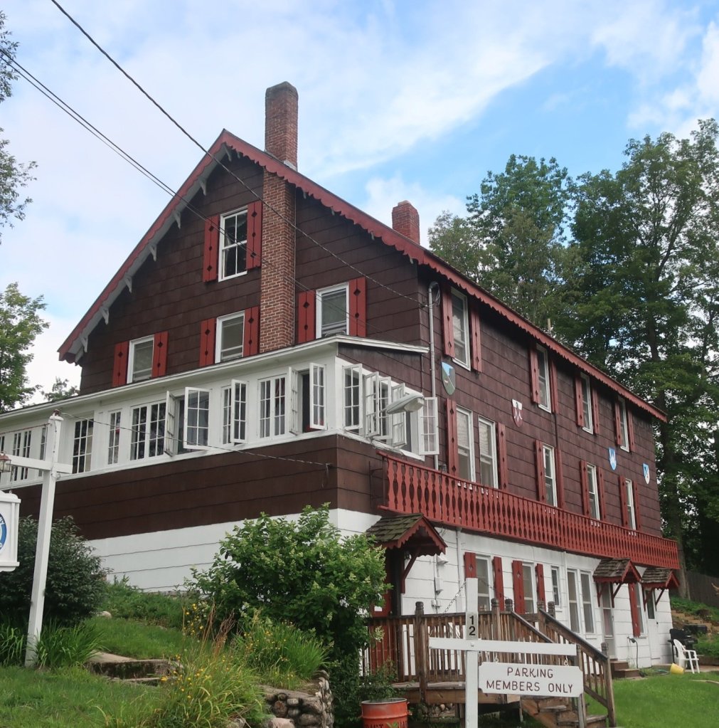
From Route 3 we hitched the 20 miles into the small town of North Woodstock. We had accommodation pre-booked at the Notch Hostel for Thursday night. They had no rooms for today so we got accomodation at the Old Colonial Ski Club Lodge right in town.
The lovely Subaru driver who stopped to pick us up was Lorrie with her college friend Kirsten. They were returning from an overnight hike to the Lake of the Clouds Hut, just below Mt Washington. They had terrible white out conditions yesterday. Lorries daughter met an Aussie and fell in love while she was an exchange student in Australia. She now lives on the Gold Coast. I so love these random encounters with such wonderful and interesting people.
I can truly say that today was a day of mountain peaks of mysery. We were happy with choices we made to hike the Presidential Range and see Mt Washington on one of the better weather days. We were not so lucky with Franconia Ridge. Rain is forecast for the next two days.
The Old Colonial Ski Club was packed with hikers because of the weather. We met a few people we’ve not seen since Georgia. The staff and a few volunteers cooked up a huge feast for dinner. We were two very happy hikers.

There are no photos from todays hike as my camera and phone were packed away all day.
*We took the Gale River Trail and Gale River Road to get off Garfield Ridge and reach Route 3. Total Distance Hiked was closer to 14 miles.
This all brings back memories from the 90s of Tuckerman Ravine and the Lake of the Clouds Hut. It was as you describe BUT the weather was fine and continued so as we hiked north. What a nightmare you’ve had through the same trails. Not long now and the gentler terrain of Vermont will be with you to the finish.
LikeLike
The Lake of the Clouds hut looks idyllic. We had little opportunity to shelter once in the alpine zone along the Presidential Range.
LikeLike