SUMMITING MT KATHADIN
AT Day 106: Saturday, July 22, 2023
Abol Pines Campground – Mt Kathadin
Mile 2183.4 – 2198.4
Distance Hiked – 15 miles/ km
Total Distance Hiked:1775.3 /km
A: 5085 ft /1551 m D: 430 ft /131 m
So nice to wake up to birdsong this morning, even if it was 4.30. It didn’t last long before the sounds of raindrops on the tent put an end to the joyful song. The drops soon turned into heavy rain. We lay in the tent wondering if it was safe to be climbing the highest mountain in Maine on such a miserable day. We accepted that there would be no views but it was the slick rock bouldering once we were above the treeline that concerned me. We decided we should go and reconsider when we reached the Kathadin Stream Ranger station where the trail to the summit begins
The heaviest rain fell as we were breaking camp. As we headed back on trail the sky didn’t look all that dark and the rain felt like it was easing. Within 20 minutes it stopped completely.
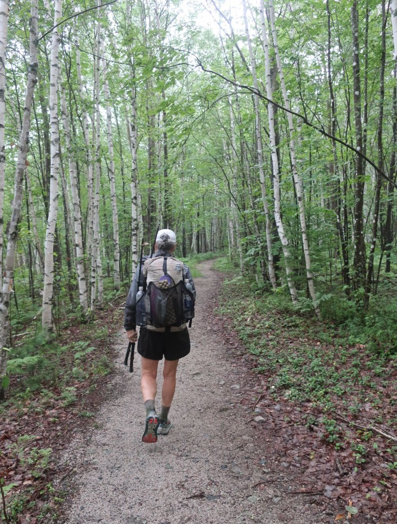
The hiking to the ranger station was done on pure adrenaline for me. Hammer as usual was unfazed by the prospect of what lay ahead. More of the same woods with wet boggy sections of trail.
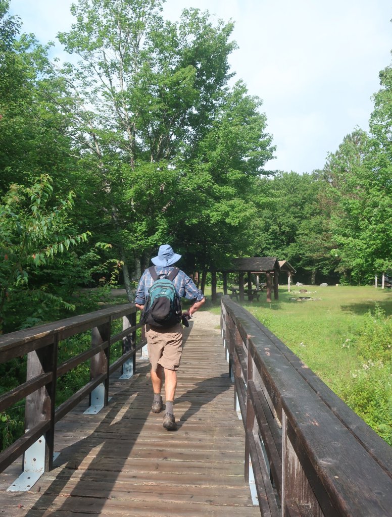
By the time we got to the Ranger station there were brief periods of sunlight breaking through the clouds. Incredible how much it lifted my spirits. We left our packs at the ranger station and took snacks, water and warm gear in a small daypack that the rangers loan out. We almost skipped out of there, light as a feather. I think we could become slackpackers after all. It was tempting to start running as the first section of the climb to the summit was on a perfectly groomed wide trail. And then it got gnarly. Hiking speed slowed as the trail started to rise.
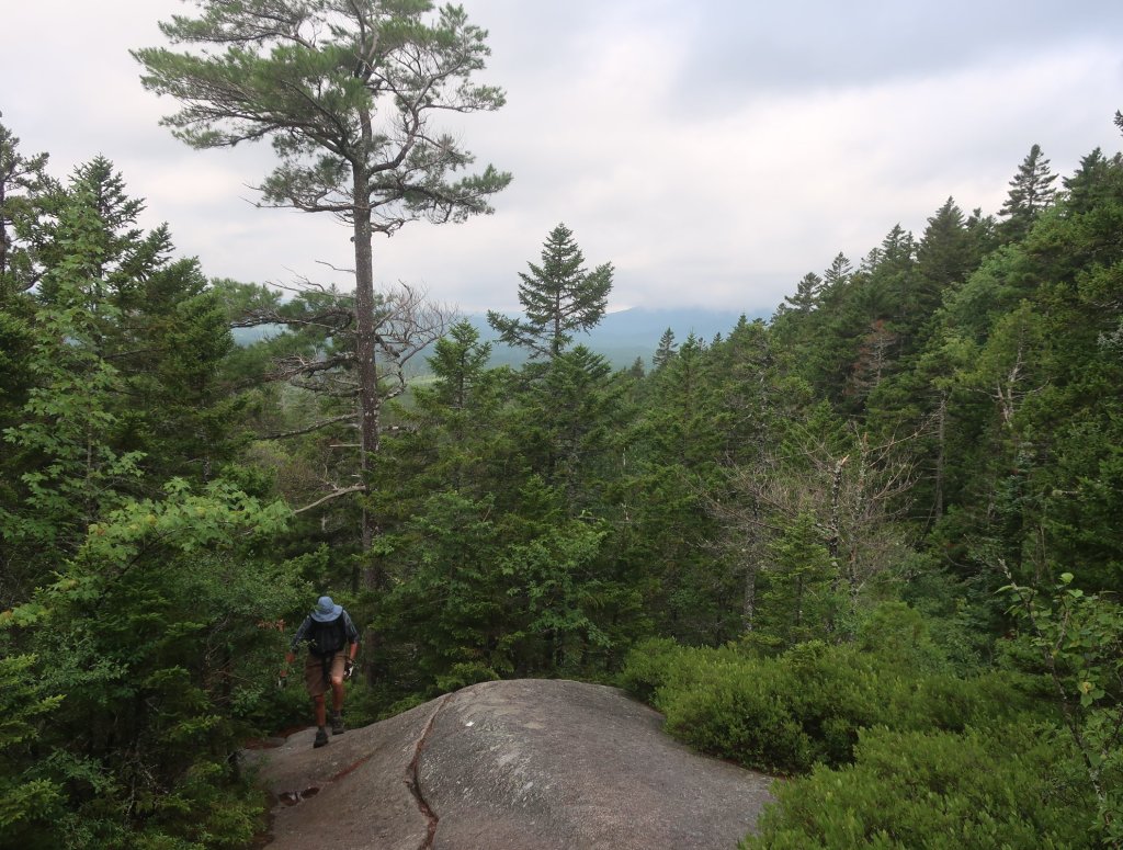

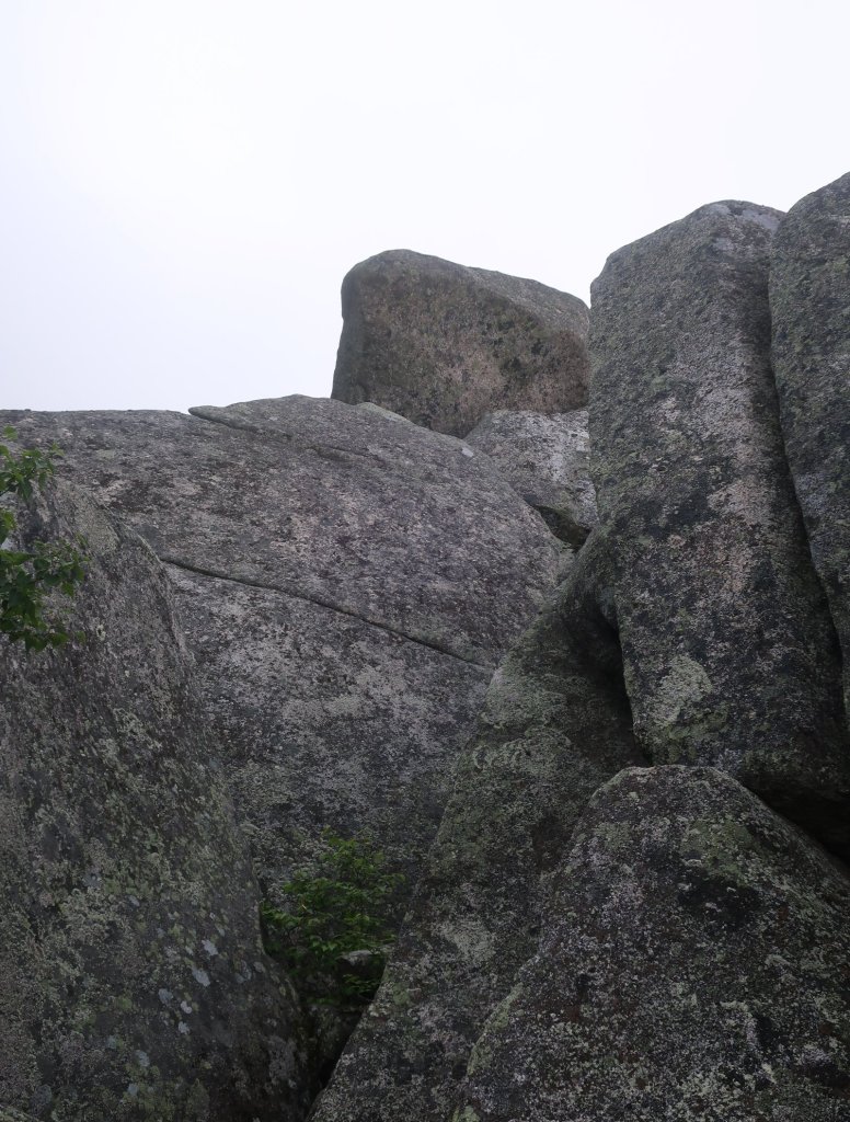
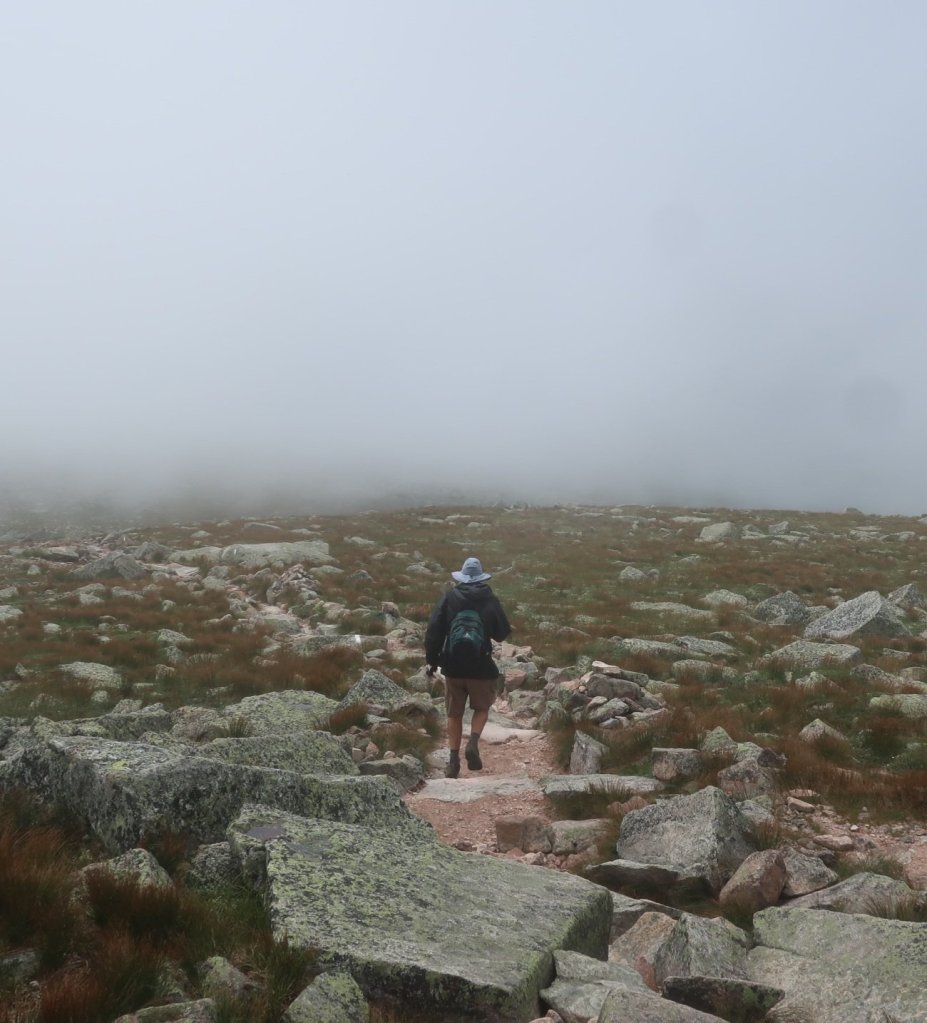
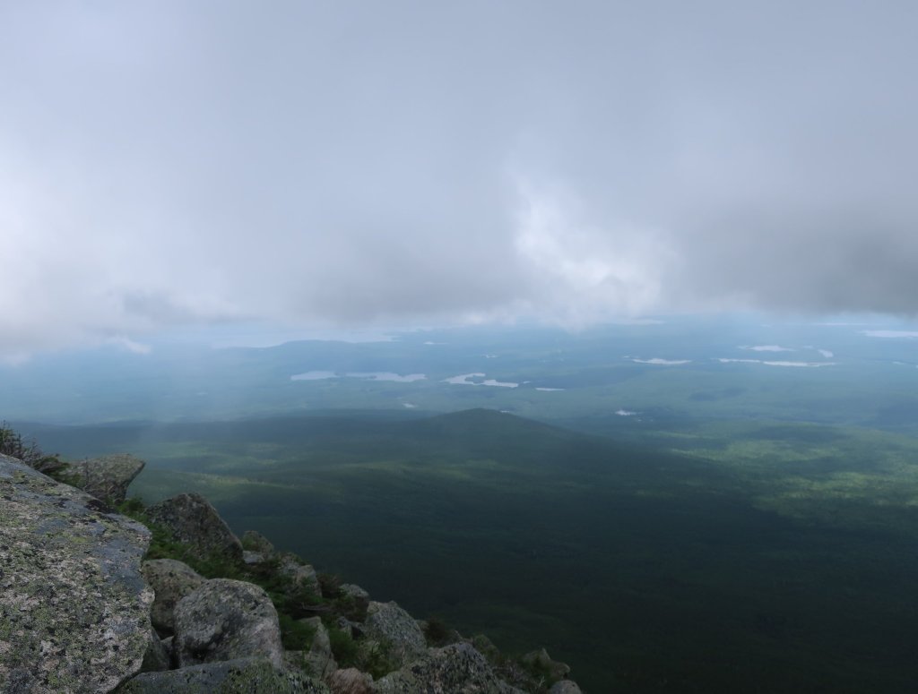
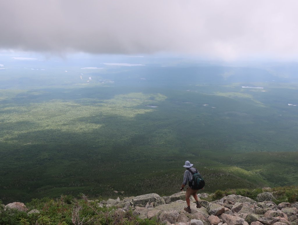
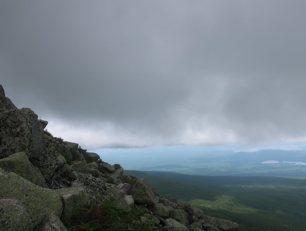
It felt like it took forever to break out of the trees and be faced by a wall of rock boulders. Luckily the way through was well marked and with a fast beating heart we set off. I knew there was an early section with rebars. I imagined a long vertical rock wall with steel bars for hand holds. Something similar to Taros Ladder we’ve climbed in the Blue Mountains back home. But luckily it was really nothing too daunting, one rebar to pull yourself up over a ledge. One more tricky narrow ledge to navigate soon after and the rest was just bouldering on all fours. We were fogged in and it helped not being able to see too far below. Although the fog would occasionally disperse and we got a view of an endless green carpeted valley below punctuated by hundreds of lakes.
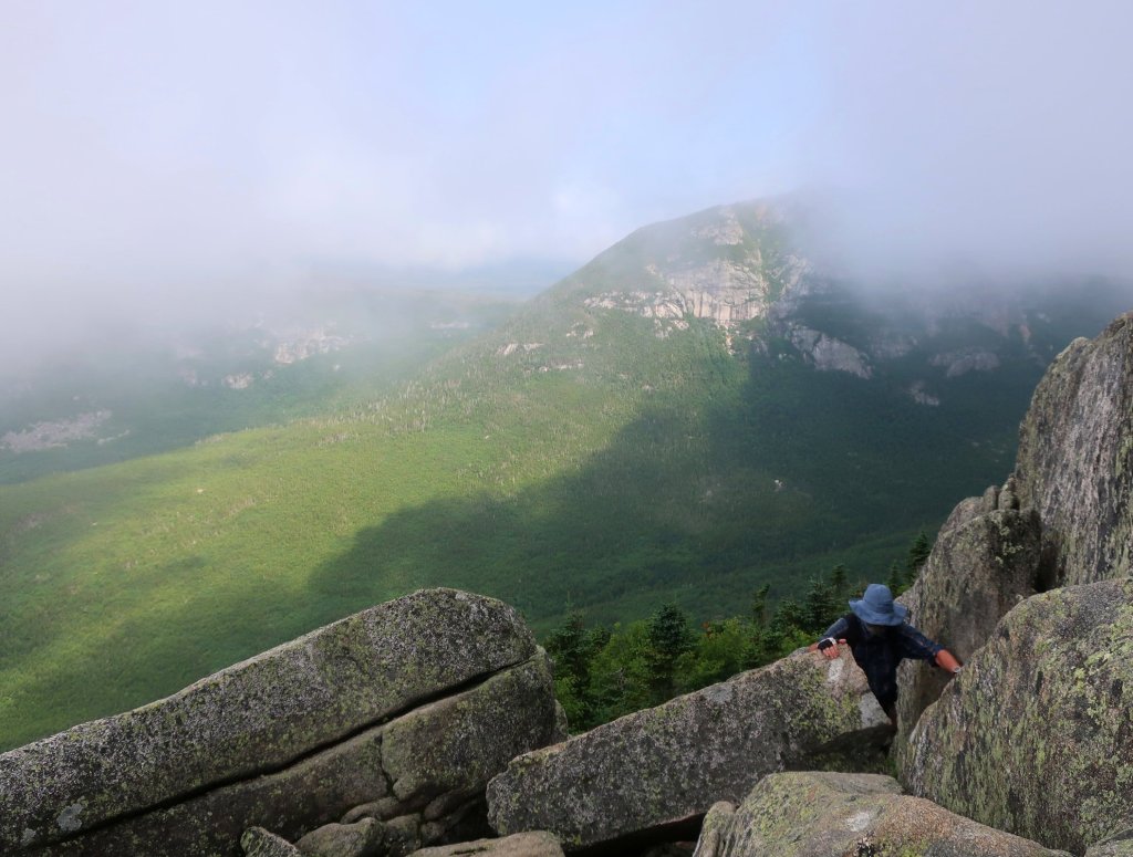


There was about a mile of steep rock bouldering followed by a flattish rising trail to the summit. This section reminded me of alpine hikes above the treeline back home. A carpet cover of low growing fragile plants. It was beautiful to be hiking through here enveloped in a fog. Especially as it wasn’t too windy and it wasn’t cold. And more importantly it wasn’t raining.

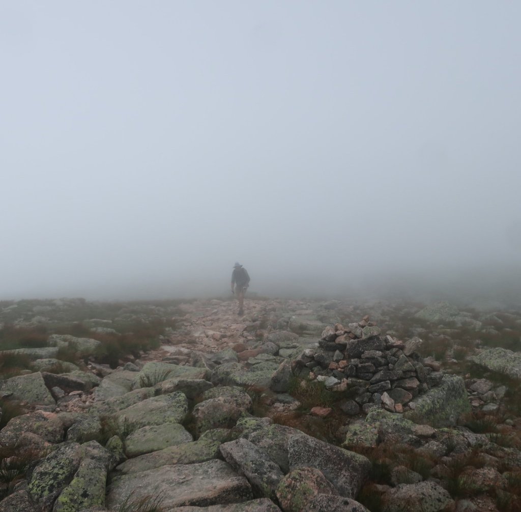
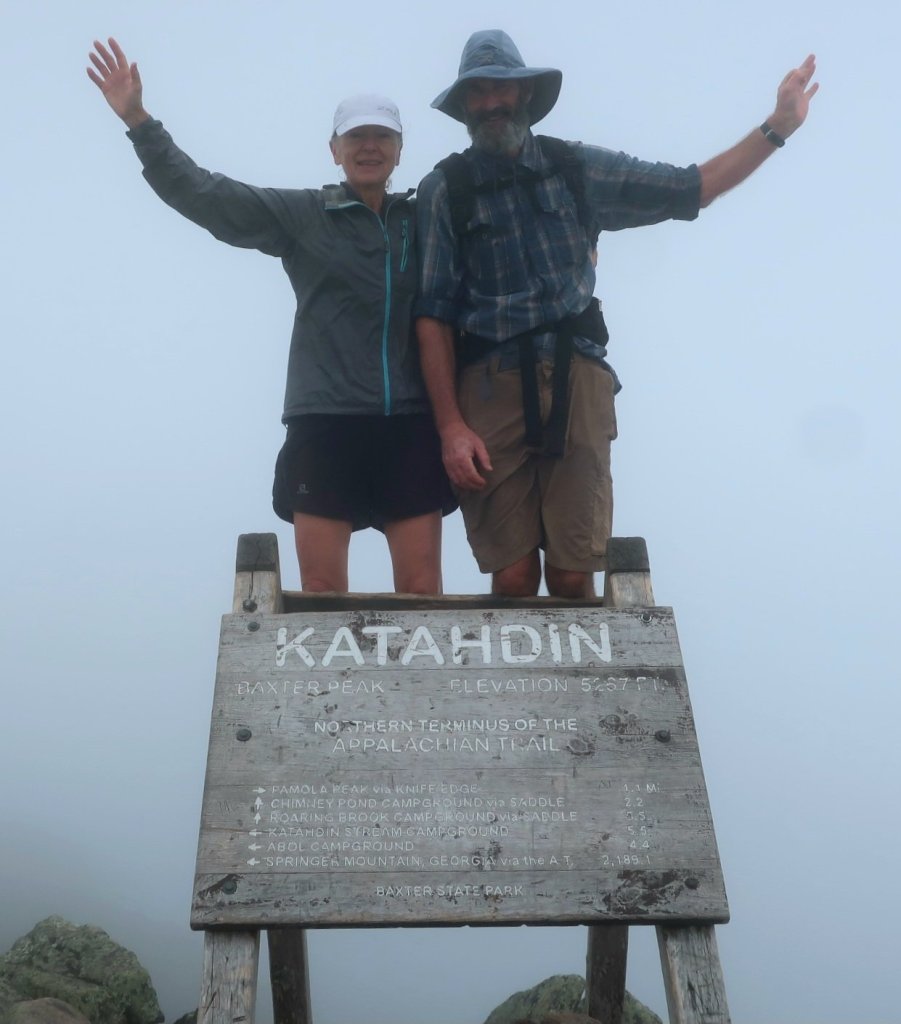
It was great to finally see the familiar shape of the sign, which marks the summit, become visible in the fog. We made it – the end but not quite the end for us. We didn’t linger here for too long as we really wanted to be descending if the predicted afternoon thunderstorm materialised.
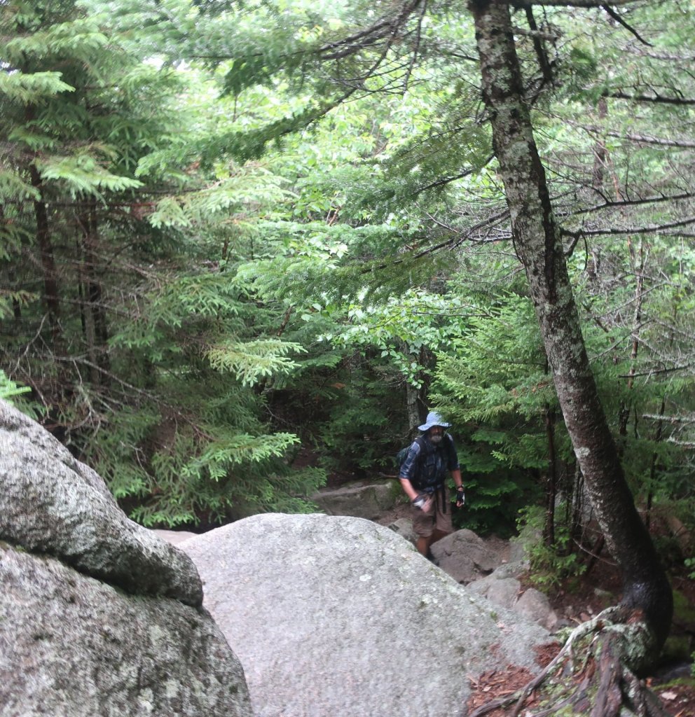
We took the Abol Trail to descend the mountain. Much steep bouldering early on and then it was a much more pleasant forested hike to the road. We had arranged to be picked up at the bottom and shuttled back to Monson. We were very happy to arrive at the road almost at the same time as Gomer Pile, our Shaw’s Hostel driver who picked us up from Bangor a week ago. We drove the two miles to Kathadin Stream Ranger Station, got our packs and our AT finishers tags from the ranger.


It was nice to come back to Monson to a much quieter Shaw’s Hostel. Back on trail tomorrow, southbound to Manchester Centre in Vermont, just a bit over 400 miles left till we are truly finished.
Congrats on getting up Kathadin!
LikeLike
How absolutely wonderful to have reached the summit even if there were no views. Now you can relax as you go south and enjoy the beautiful White Mountains of New Hampshire
LikeLiked by 1 person
Thank you Carolyn.
It was a relief to get the summit done. Looking forward to the Whites and a spell of good weather.
LikeLike
Thank you Anna.
LikeLike
Congrat’s on Kathadin!! Amazing photo’s in all your posts.
LikeLike
Thank you for your kind words Marc.
LikeLike
Congrats on summiting Kathadin!! Really enjoying your blog and wonderful photography!
LikeLike
Thank you Huskies4us
It was such a relief to get the summit done.
LikeLike
You guys are awesome- keep going . We’re loving the commentary. The Thursday runners dissect your week’s progress and the general consensus is that you’re certifiable. Love from us.
LikeLike
Welcome back & congrats on the climb and what a climb, amazing 👏 also Happy Birthday Stef, “Hip,Hip, Hooray” – cheers Maree 🥳
LikeLike
Thank you Maree, we are looking forward to coming home.
LikeLike
somewhat of an anticlimax scuse the pun but congrats on your summit of Kathadin!! enjoying your blog your photos are amazing
LikeLike
Thank you Tracey. We were jealous of the hikers who were finishing.
LikeLike