CHESTNUT RIDGE
AT Day 037: Sunday May 14, 2023
Mile 552.5 + 23.5 miles / 37.8 km
Total Distance Hiked: 576 miles / 927 km
Crawfish Campsite – VA Route 610 – North Fork Halston River – Knot Maul Branch Shelter – Lick Creek – VA Route 625 – Chestnut Ridge – Chestnut Knob Shelter – VA Route 623
A: 6312 ft/ 1925 m D: 5056 ft/ 1542 m
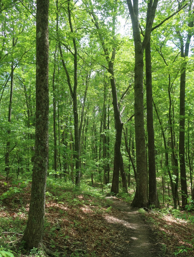
Reed Creek where we were camped last night was probably one of the nicest camp spots we had. We both had such a good night’s sleep. I don’t know why, it was just a lovely spot. A little bit of frog serenade at night and then in the morning we woke too a bird symphony. And the best part, no condensation in the tent or groundsheet. The humidity on the other hand was oppressive. It felt like it was 100%. We broke camp in the dawn twilight and within 10 minutes of leaving camp we were soaking wet. Even though the air is lovely and cool but the humidity just makes you work that little bit harder. As were leaving a creek the trail ascended for about 2 miles. A green tunnel with nothing remarkable surrounding us except through the canopy we could see faint traces of pink in the sky. Sunrise was illuminating the whispy clouds.
While the sun was rising we made quick work of the two mile climb out from Reed Creek and as we got to the top of the ridge it was just the most beautiful, mist covered the woods and the cooler air temperature made for just lovely hiking.
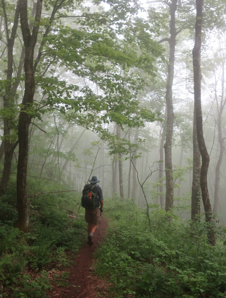

The descent from the ridge was a literal walk in the park, lush green growth and birds singing soft trail underfoot and it wasn’t raining – it could not get any better.
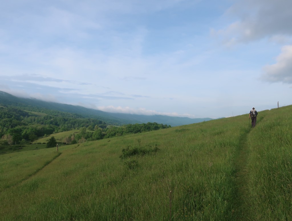
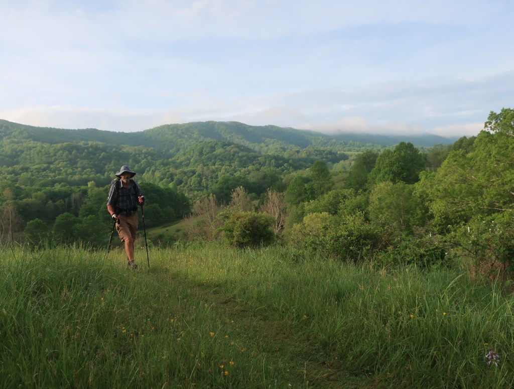
It was still early morning when we left the woods, crossed the road and then started to ascend through a grazing meadow. Cows scurried to get away from us. When I turned back, behind us was the most beautiful vista of a mountain plateau, the tops of which were shrouded in mist. Virginia was looking mighty beautiful when we could see it outside the green tunnel.

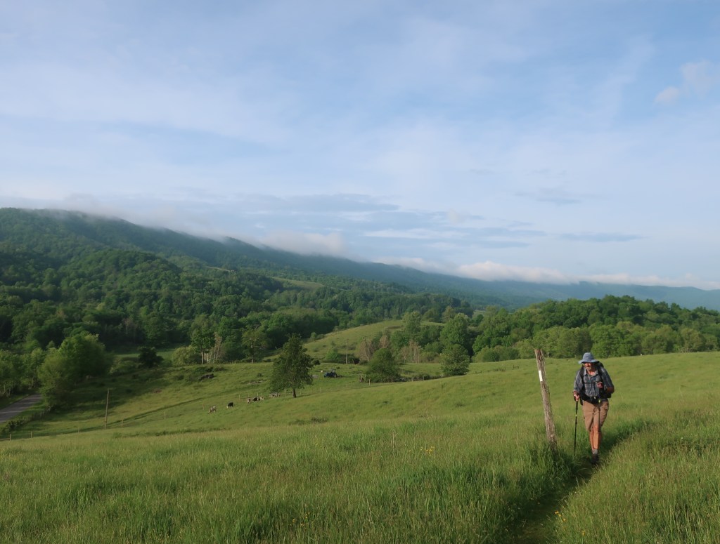
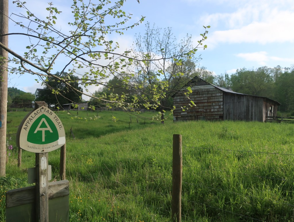
Lovely morning although still very warm and humid. Soon after we crossed another road and a river on a solid stone bridge and now have 10 miles of hiking on a narrow coridor through private property with grazing cattle and lot of styles to go over.
Nothing remarkable , the trail undulated along a creek through the woods. The trailside greenery was occasionally broken up by the rhododendron in bloom in every shade of pink imaginable. Hammer said the humidity reminded him of hiking in New Guinea, where you get wet from sweat when you start and just stay soaked the rest of the day.


Our respite from warm weather bugs was also over. Small gnats started to appear and were flying into my ears, eyes and nose. Hammer was left alone – maybe by hiking in front I was taking the hits for the team.
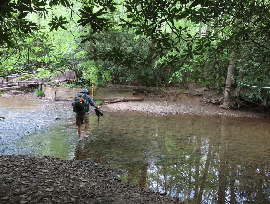
We stopped for lunch by Lick Creek at a washed out bridge, where we had our very first river ford on the AT. Sierra scary it was not, the water was ankle deep and gentle flowing. Although looking at the timber logs piled downstream it clearly gets much bigger flow at times.
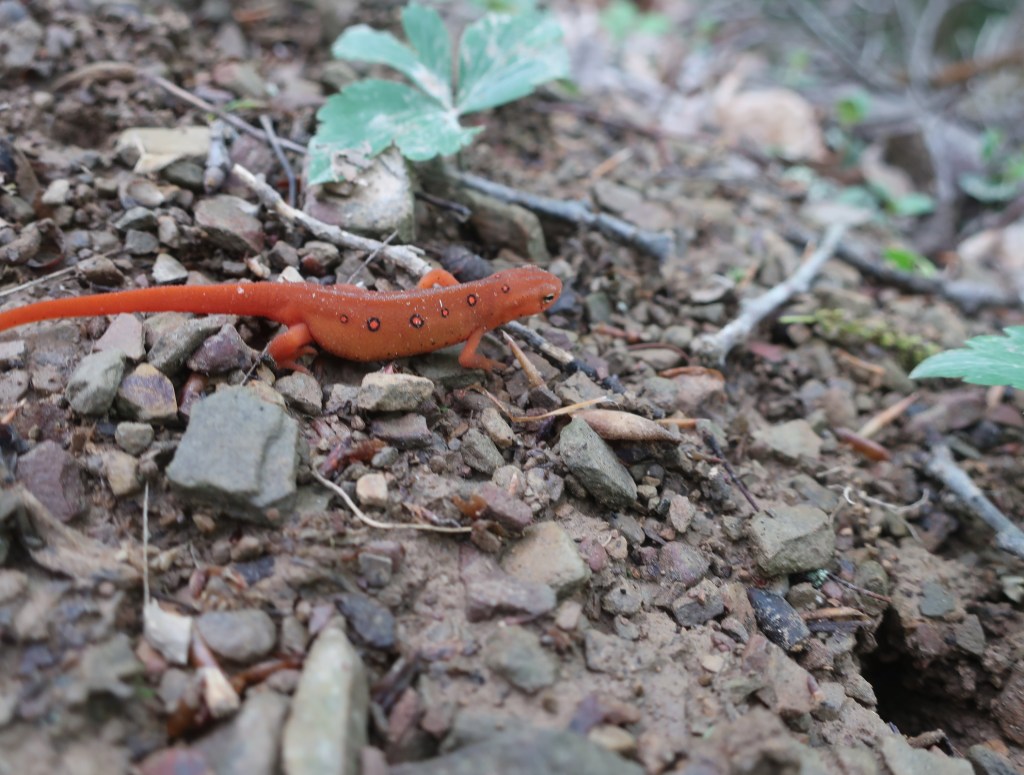
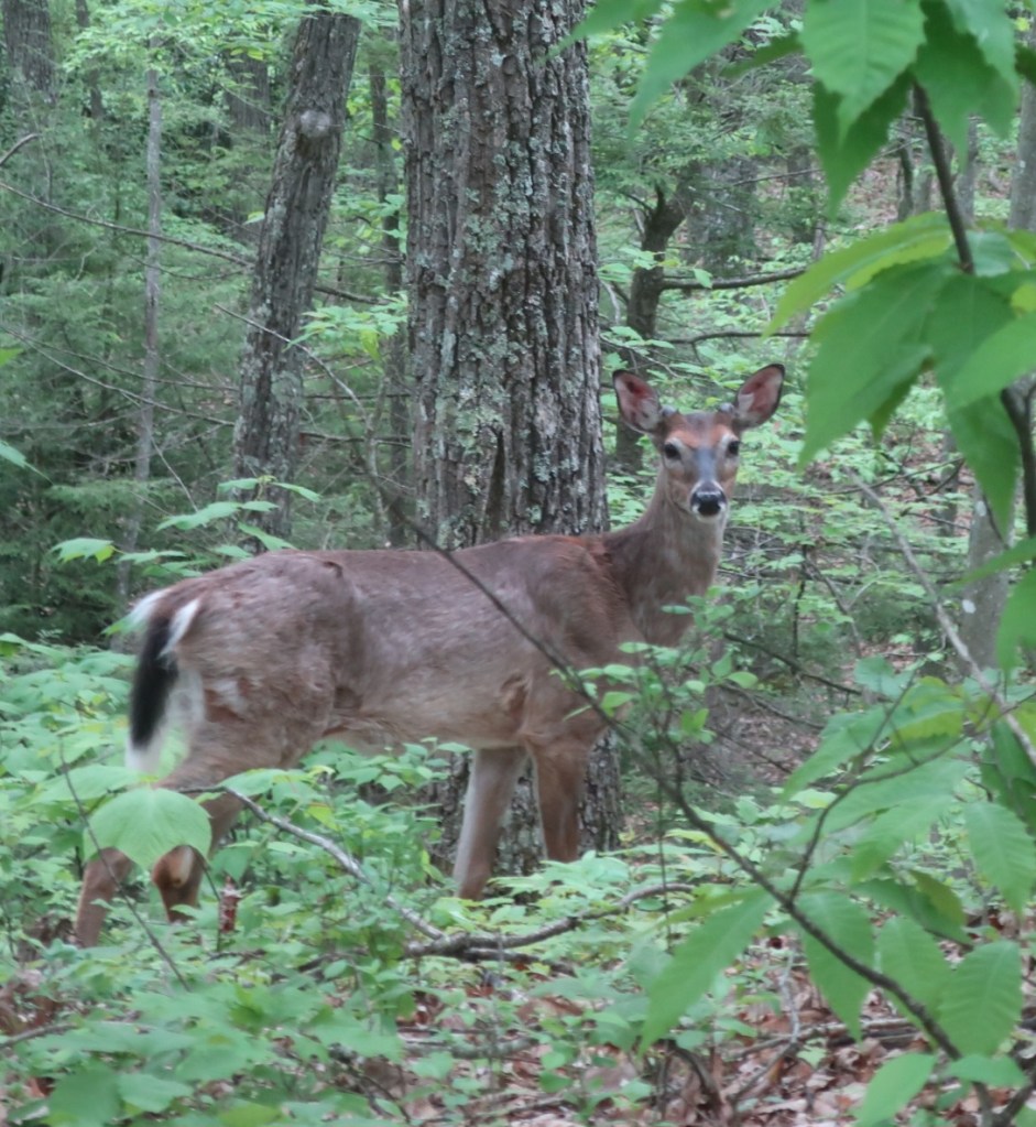
After lunch we hiked a short distance to VA road 625 and were surprised to find a trail magic – a cold drink and a chocolate bar. Wow that was a surprise – it was only after I looked at the map of the next hike segment that I got the purpose of the trail magic. We had a five mile 2000 foot ascent towards Chestnut Ridge and the Chestnut Knob Shelter. Yikes, sometimes it’s better not to know in advance. Fortified by the sugary drink and saving the chocolate bar for a treat along the way we slowly made progress. It was just plain hard work. I was having dark thoughts about all those folks who told us Virginia was flat – fooey …it’s not true. Taking a bite of the chocolate bar every half hour as a reward I made my way up. Hammer just put his head down and soldiered on very slowly. He was so slow that he managed to see a snake which I walked past and a pink lady slipper orchid which I also missed.

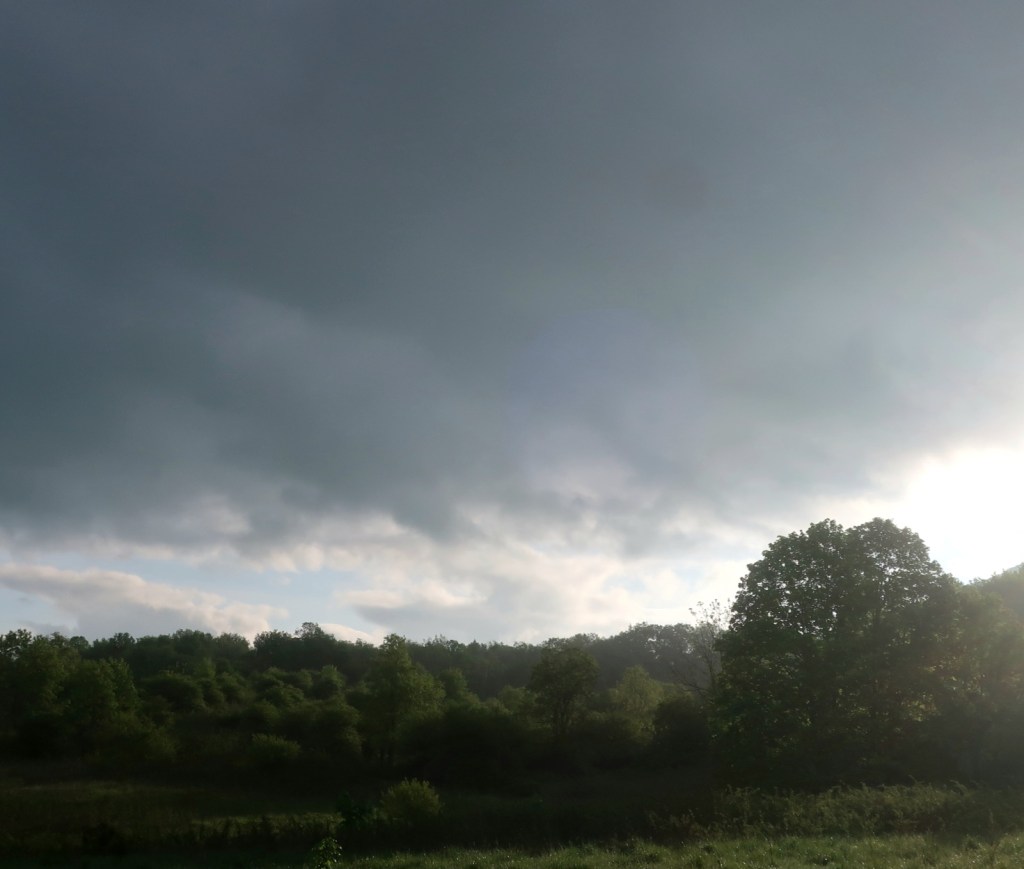
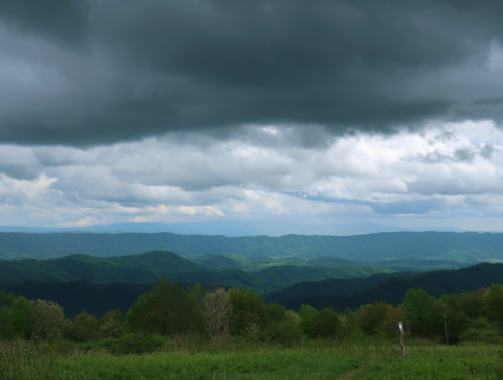
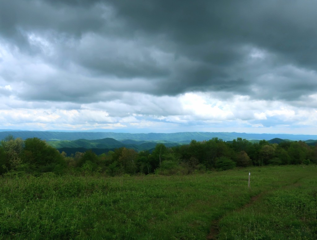
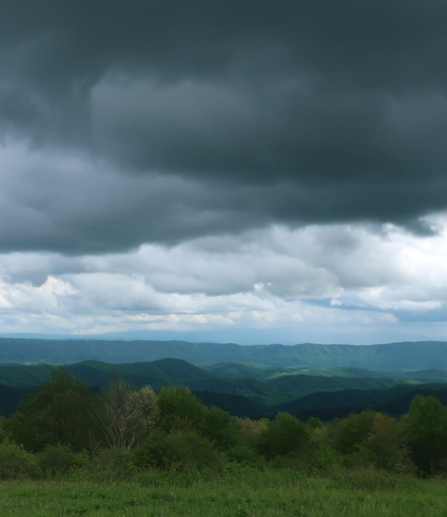
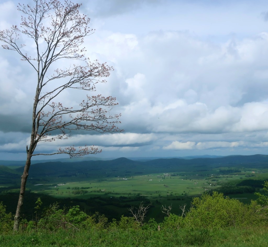
The woods slowly receded behind us as we started the climb up Chestnut Ridge through a grassy meadow. Turning back the view behind us was pretty damn special. Virginia although not flat, looked mighty pretty from this vantage point. Distant view of a long flat eroded plateau that stretched out towards the horizon, enclosing a flat valley. The darkening sky added to the dramatic look of the landscape.
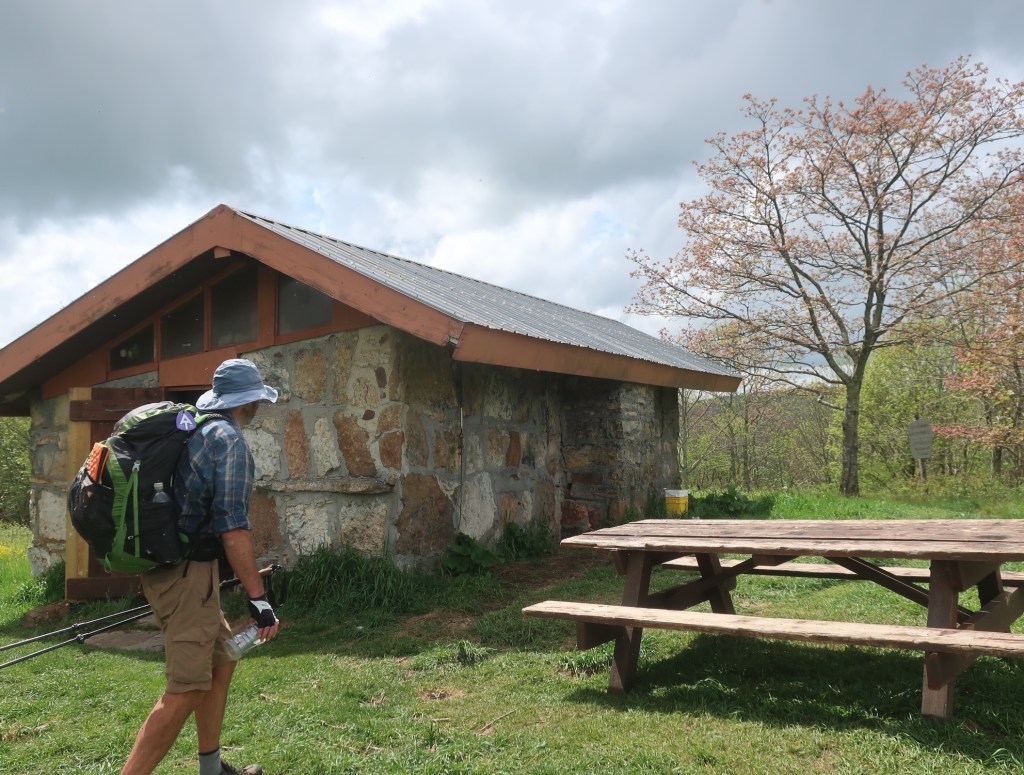
This afternoon was a rare occasion on this trail where all the climbing grunt work was rewarded by amazing views. Chestnut Knob Shelter sat at the top of the ridge. A beautiful stone shelter one of the rare ones with four sides and a door. The view of the valley below from the shelter was pretty special. Houses and farmland, everything looked so lush and green.
It was still too early in the day for us to stop so we hiked another six miles over a rocky undulating trail to reach a road, VA Route 623. This last section was very tough on our feet and Hammer took a heavy fall on a slippery rock. He has a sore wrist but he tells me it’s fine. I guess we’ll find out in the morning.
Beautiful and pastoral but all of that humidity reminds me of summers in New England.
LikeLike
The humidity feels almost tropical.
LikeLike
Oof! Sorry to read about Hammer’s fall. I hope he is okay.
LikeLike
He was fine the next day. His pride on the other hand was a bit dented
LikeLike
Are the styles to keep out wildlife or to keep the cattle in their respective paddocks? Quite sturdy construction.
I hope Hammer is ok.
LikeLike
I think to help us get over property boundaries
LikeLike
Hammer was fine the next day. Although his pride was a bit dented
LikeLike