SOUND OF SILENCE
Days 30-33, May 25-28, 2022
Ikara-Flinders Ranges National Park
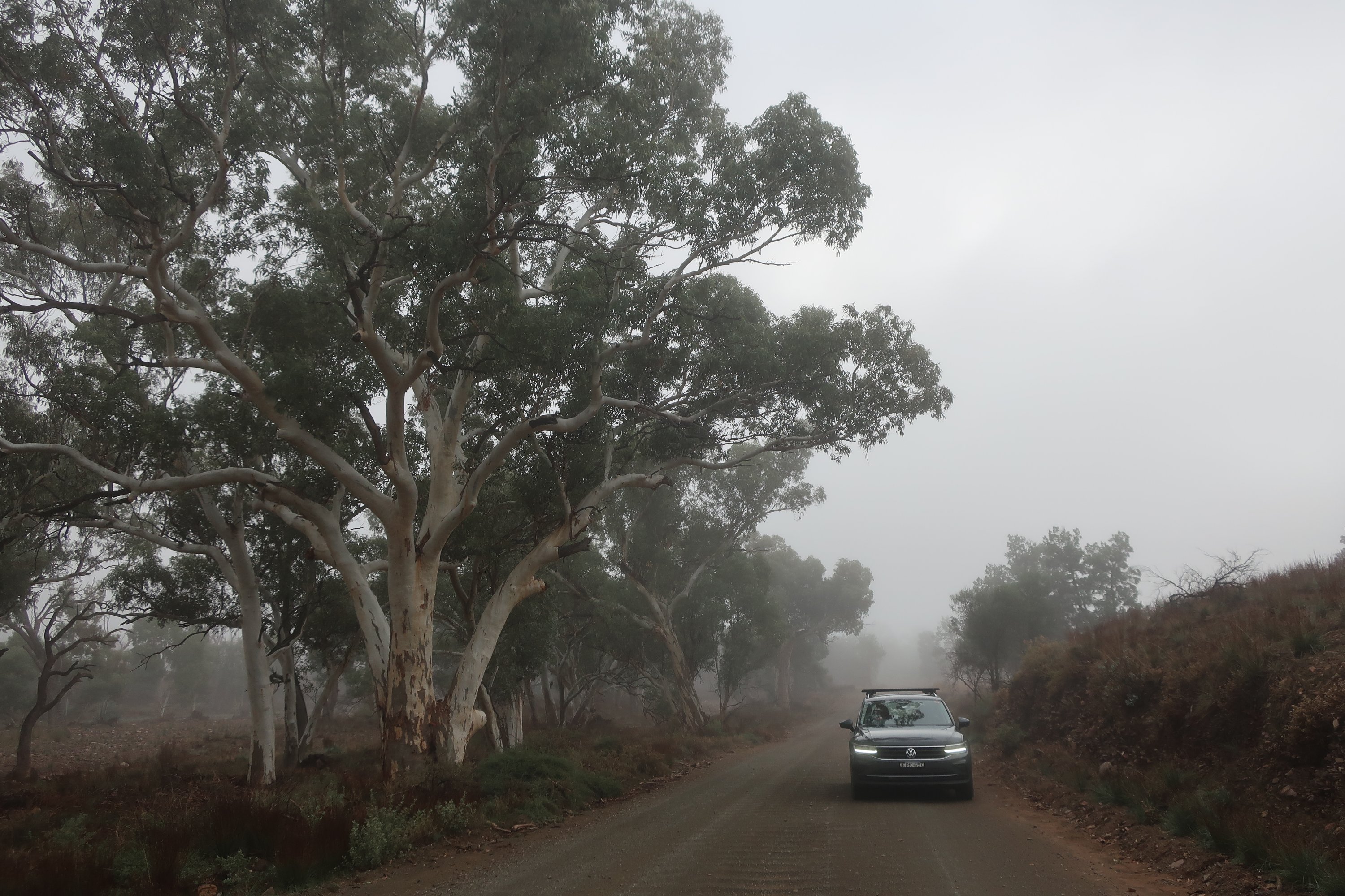
We left Port Augusta early Wednesday morning, eager to finally head through the iconic red earth of outback Australia. Starting with Ikara-Flinders Ranges National Park. This is another long post with lots of pictures.
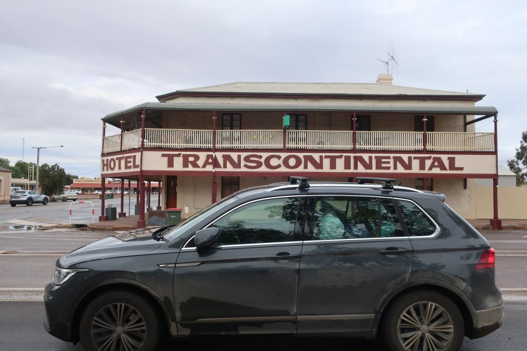
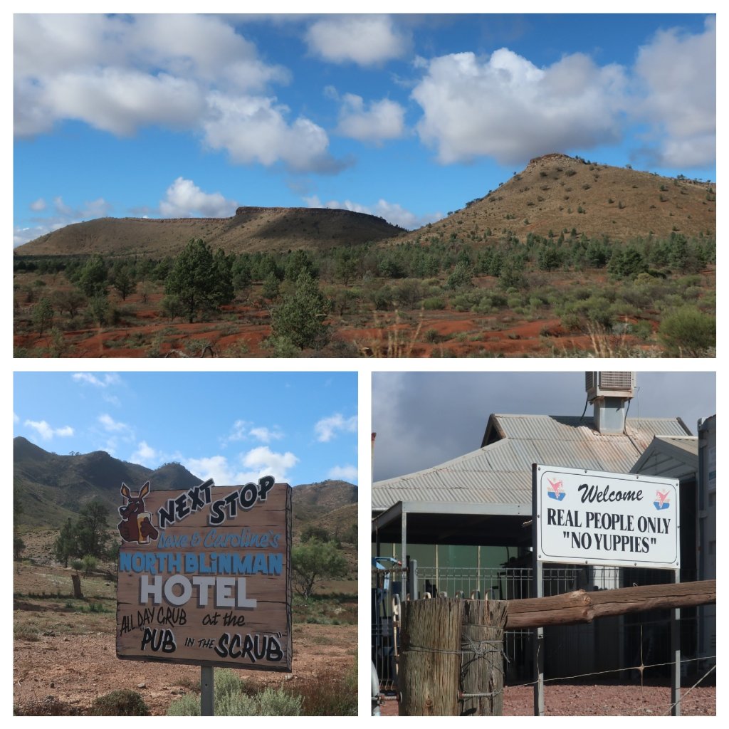
Our first stop was the small township of Quorn. Once a thriving town on the Old Ghan Railway line from Adelaide in the south to Alice Springs in the north, the rail line now bypasses the town. Although the heritage listed Pichi Richie steam train still runs to Port Augusta from here, only as a tourist attraction. Quorn is a lovely small heritage town which still serves the local farming community.
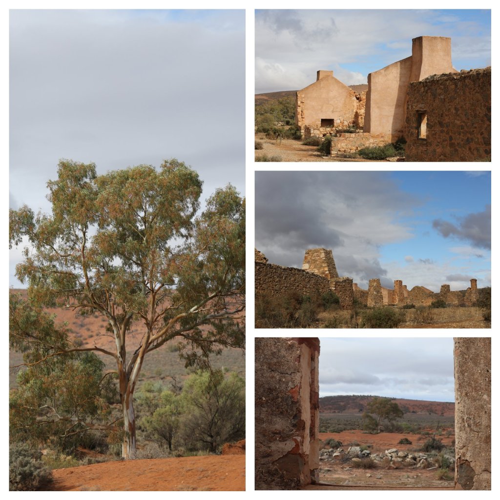
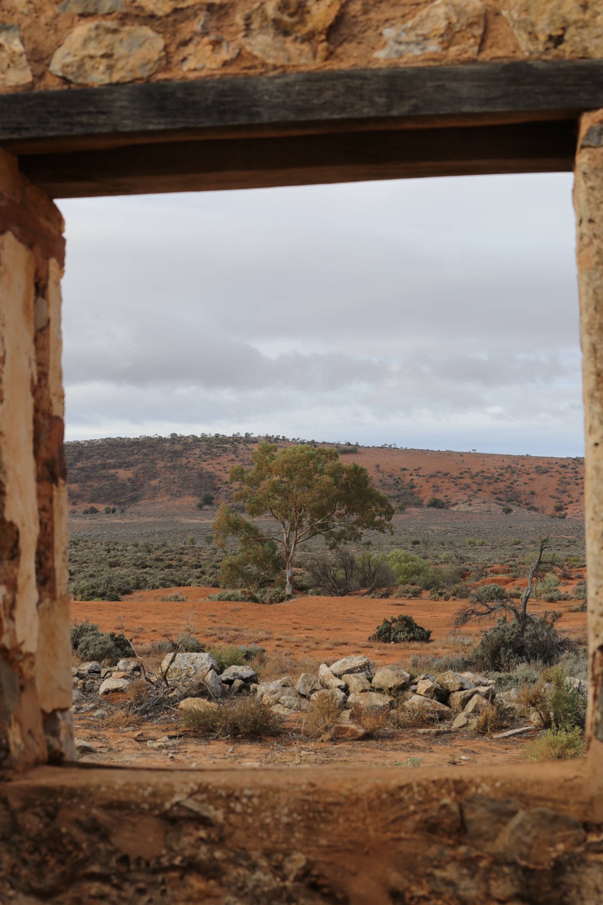
Distant mountains started to take shape as we left Quorn. Ruins of colonial buildings are found throughout South Australia. We stopped briefly at the ruins of Kanyaka Station which in the late 1800’s was the centre of a thriving pastoralists settlement.
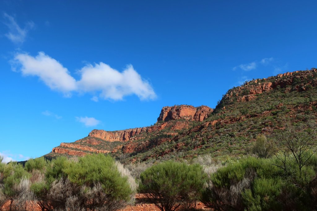
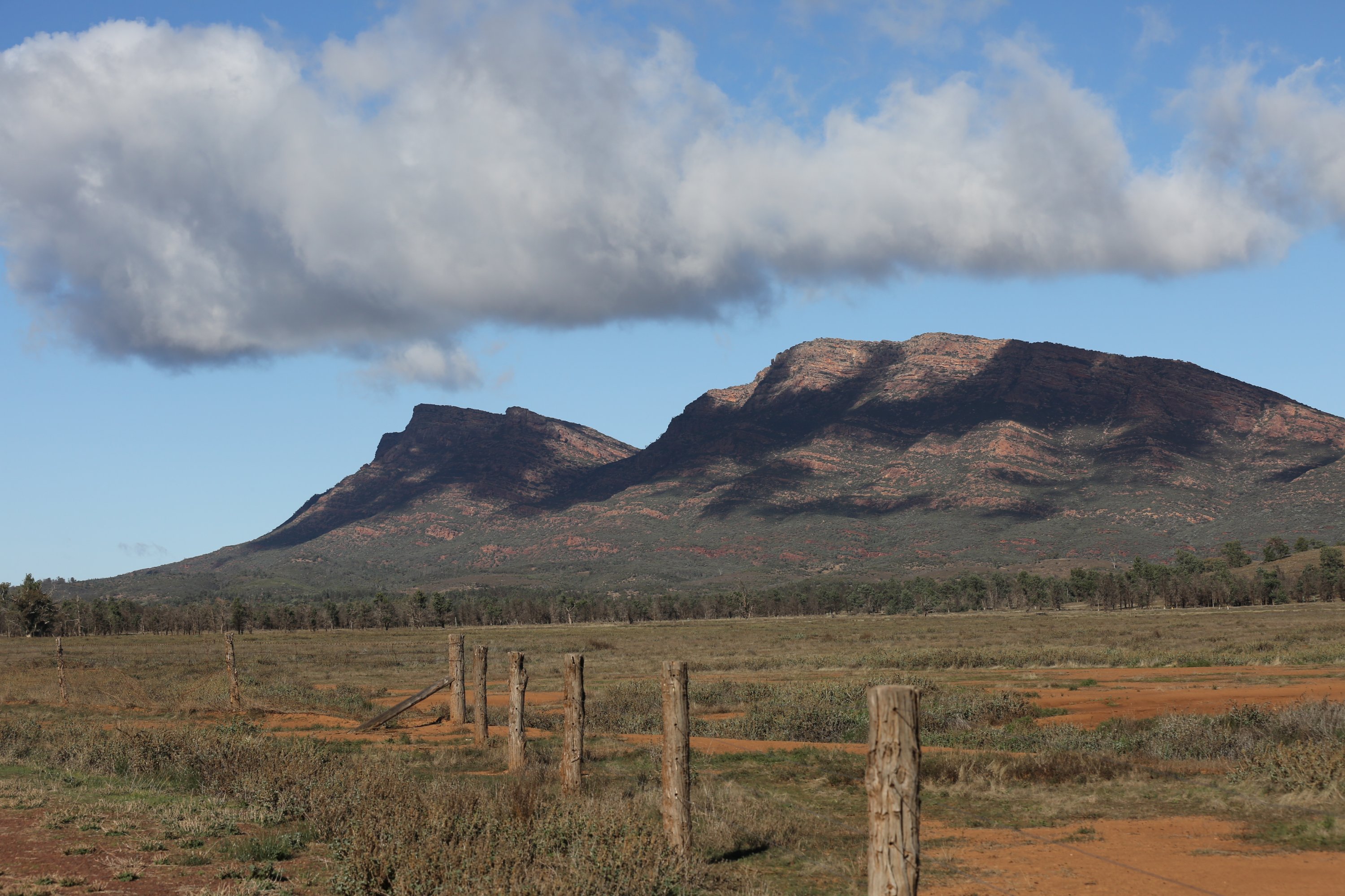
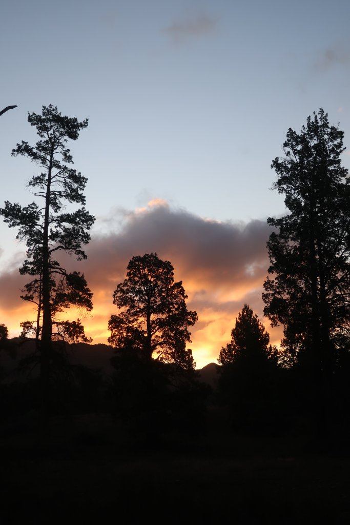
Before too long, we were approaching Rawnsley Peak which marks the southern end of Ikara-Flinders Ranges NP.
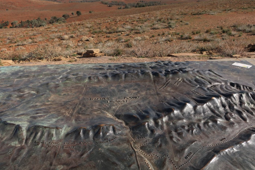
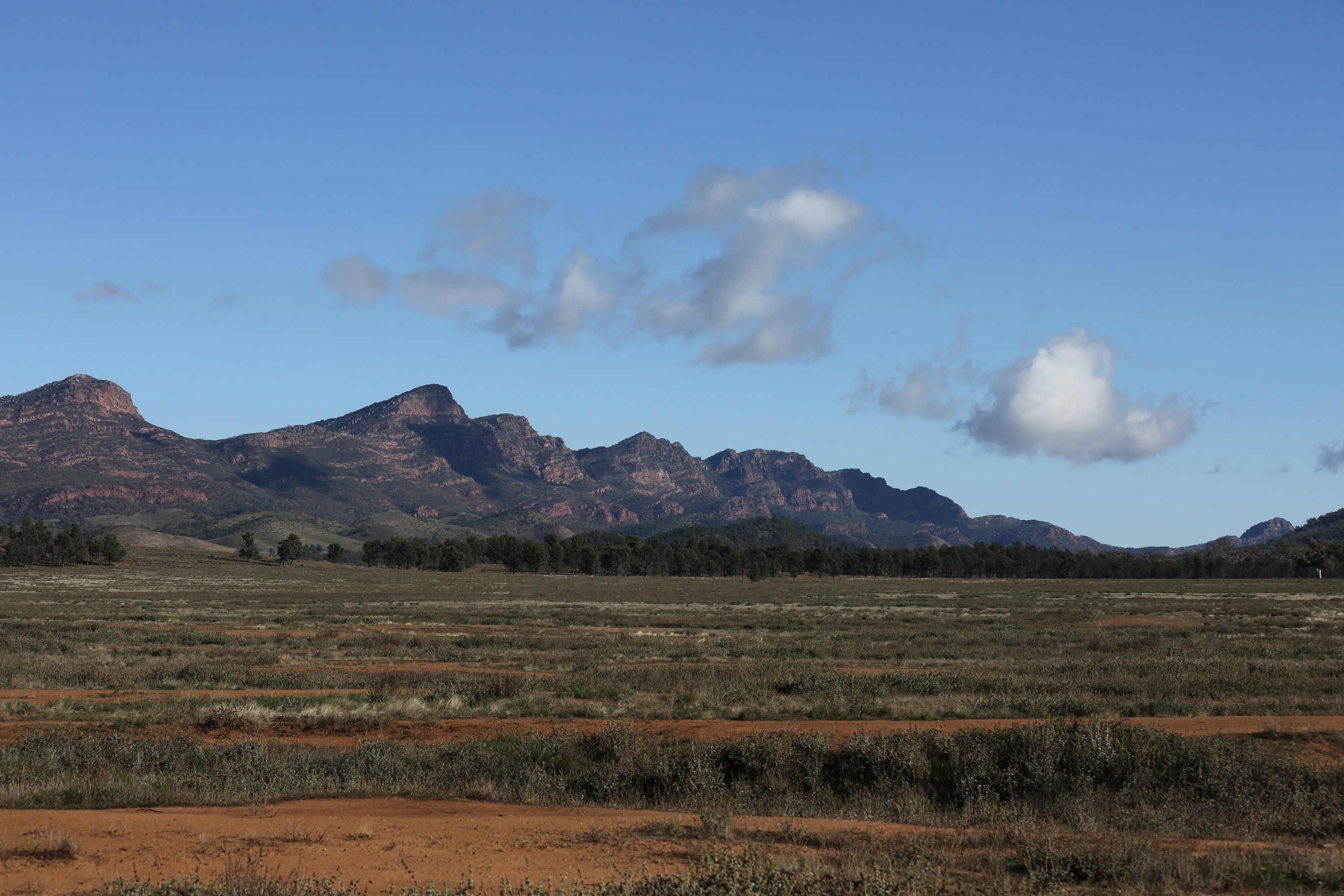
Jagged red rock peaks stretched out in front of us. The afternoon light lit up the rock faces. It was difficult to fully take in the shape and structure of the range. And it will be a few days into our stay here before we more fully comprehended the landform. We stopped briefly at Wilpena Pound, the heart of Flinders Ranges. Wilpena Pound is a remarkable natural amiphitheatre covering nearly 8000 hectares. It is a huge flat plain covered in scrub and trees and totally surrounded by jagged hills which form a rim. The Pound is also home to a Visitors Centre and a Resort which offers a range of accomodation.
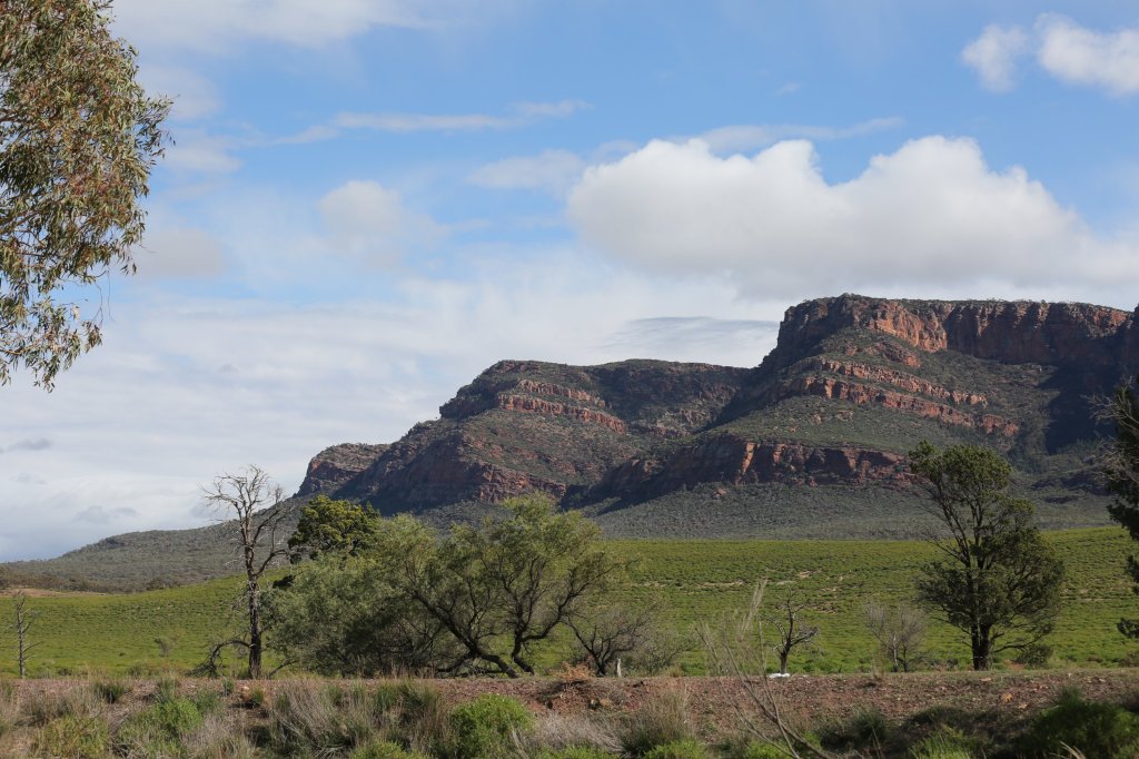


The Flinders Ranges began forming about 800 million years ago, when an ancient sea deposited sediments in a basin known as the Adelaide Geosyncline. Around 300 million years later, the basin sediments were folded into mountains, which have since eroded.
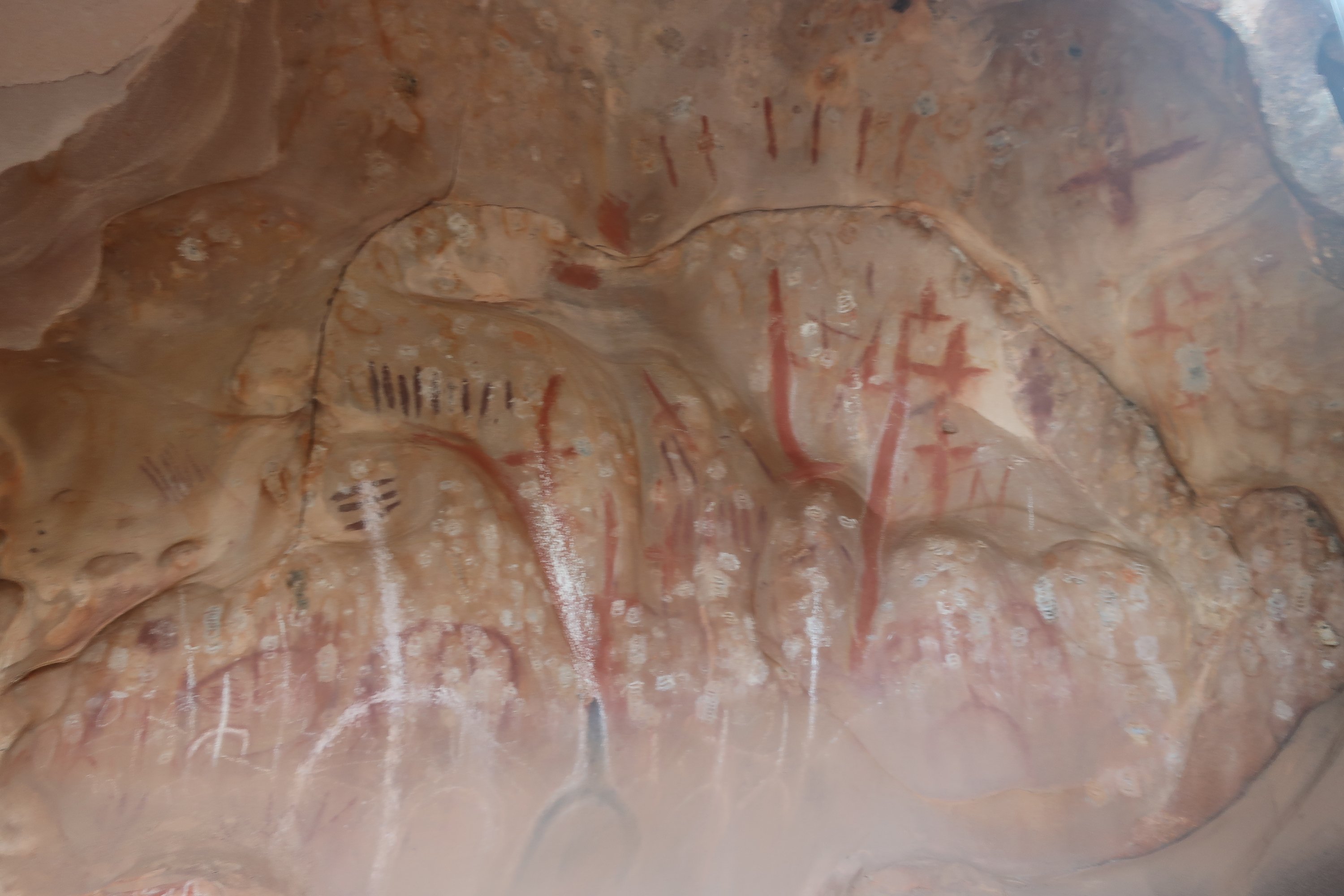
The first humans to inhabit the Flinders Ranges were the Adnyamathanha people (meaning “hill people” or “rock people”) whose descendants still reside in the area. Cave paintings, rock engravings and other cultural artefacts indicate that the Adnyamathanha lived in the Flinders Ranges for tens of thousands of years.
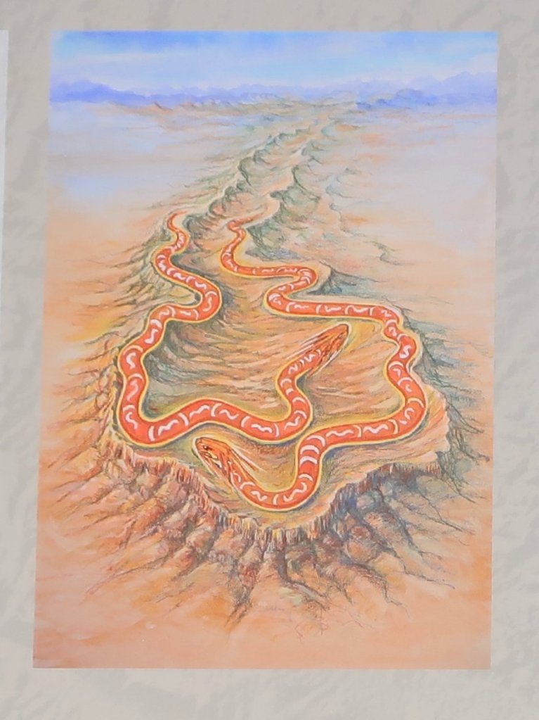
Aboriginal legend tells how Wilpena Pound was formed by the bodies of two giant serpents that could not move after eating the people who had gathered there for a ceremony. St Mary Peak forms the head of the male serpent, while Beatrice Hill forms the head of the female.
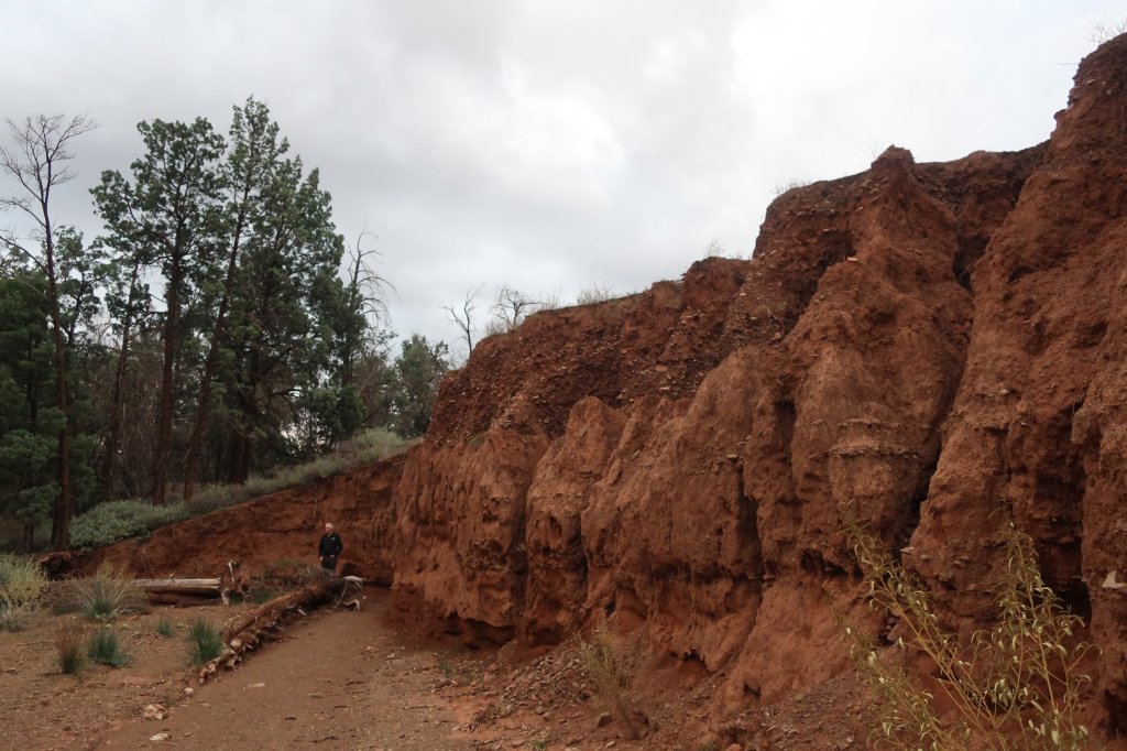
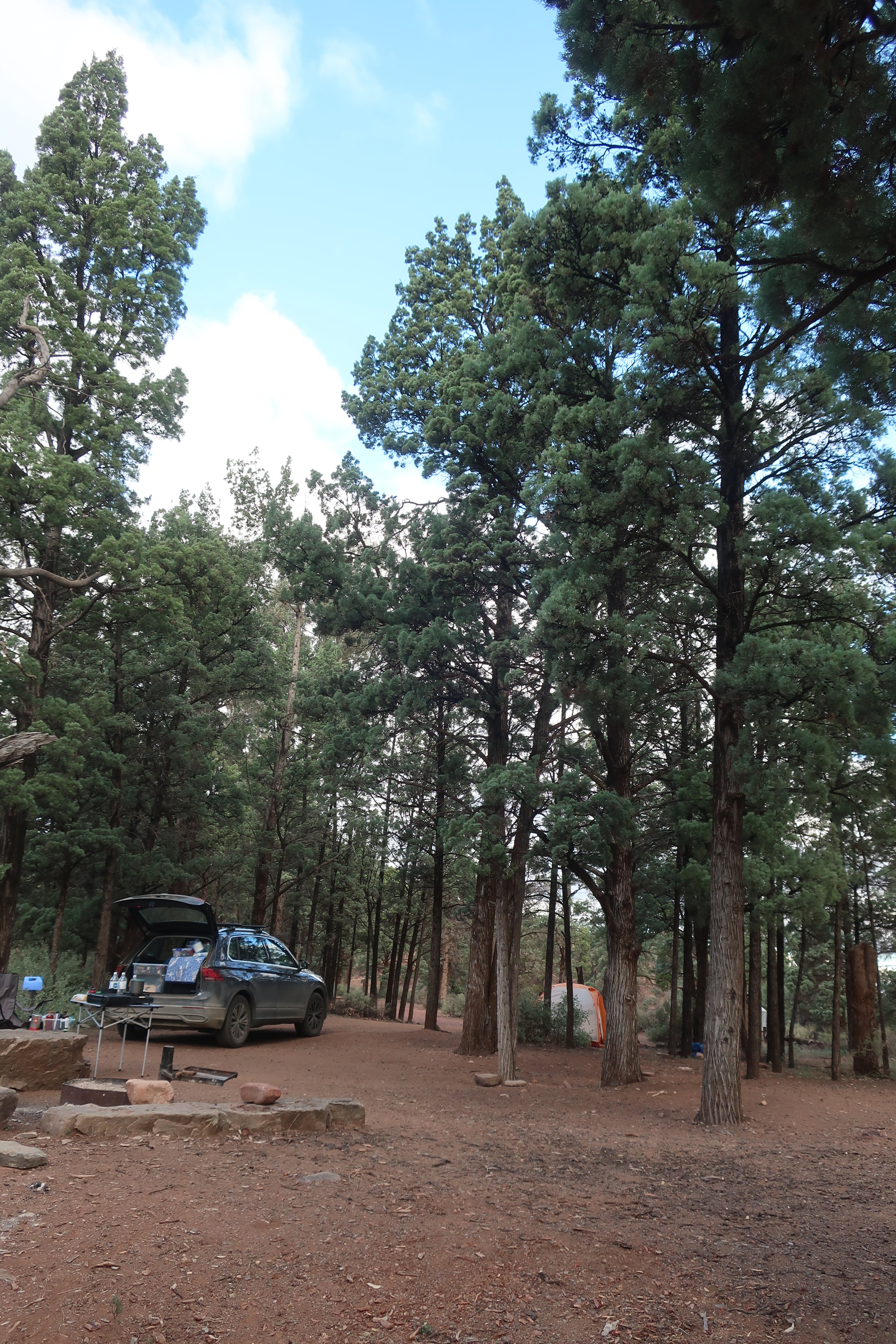
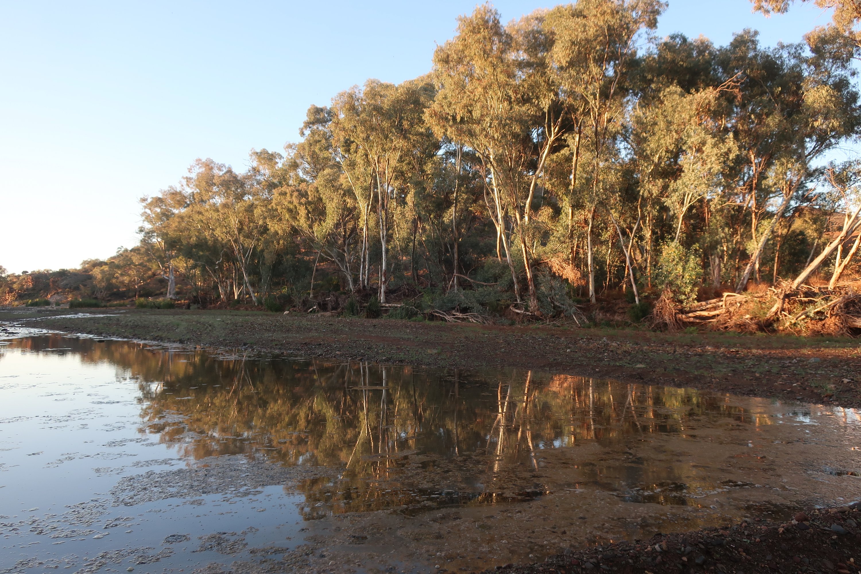
We were staying at Kooloman campground in the Aroona Valley, at the northern end of the Park approximately 50km north of Wilpena Pound. Our campsite was on a riverbank and judging by the erosion of the banks, the river must have had significant flows in the past.
We were the only people camped here. It was incredibly silent as night-time approached. Not even the russle of wind. Only the occassional hooting of an owl broke the silence. I don’t think we’ve ever camped anywhere that was so silent.
Thursday – May 26th, Day 31
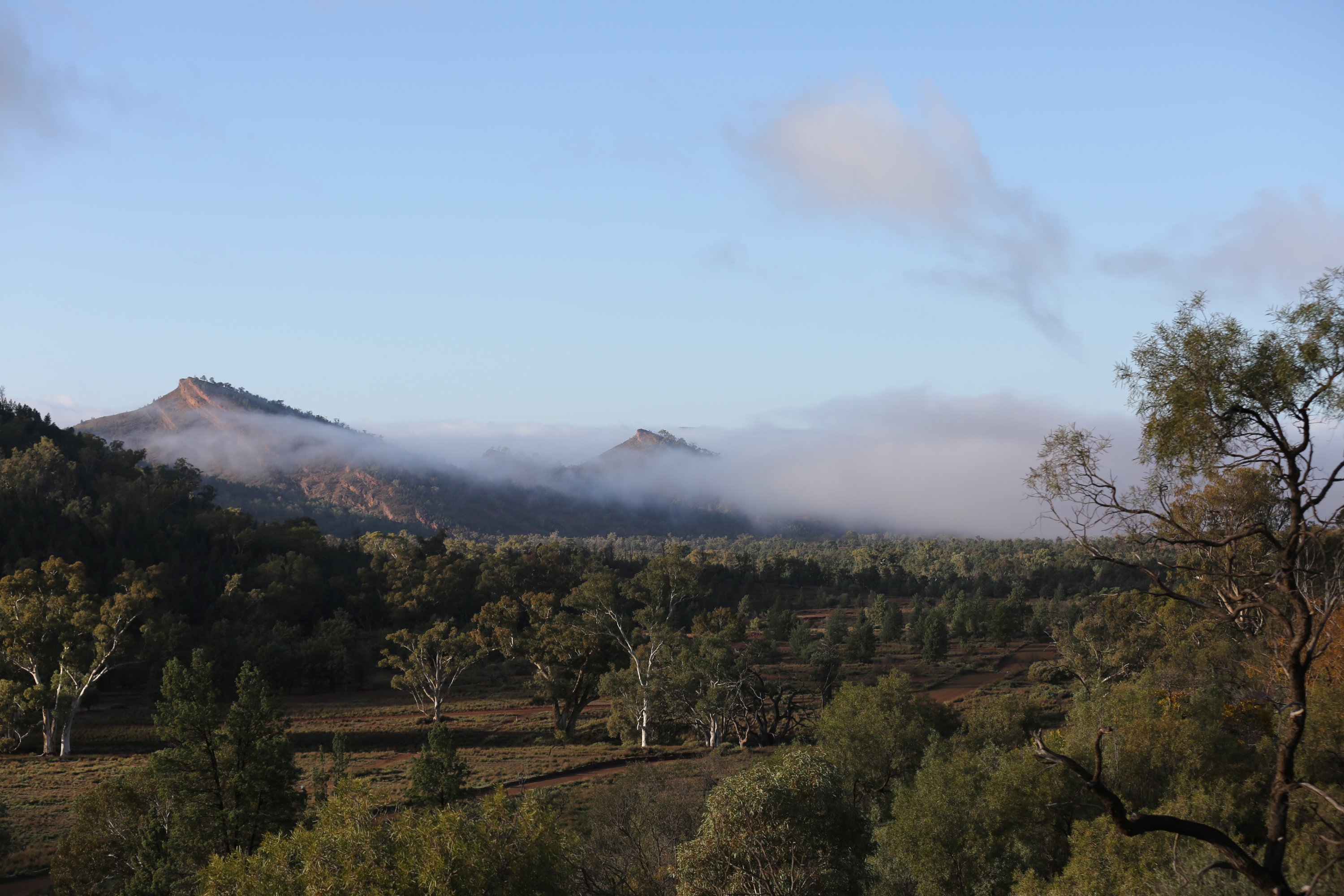
This area of the Flinders Ranges is classified as being semi-arid. So we were surprised to be woken through our first night to reasonably heavy rain. The rain does seem to be following us. We woke on to a very still, fog filled valley.
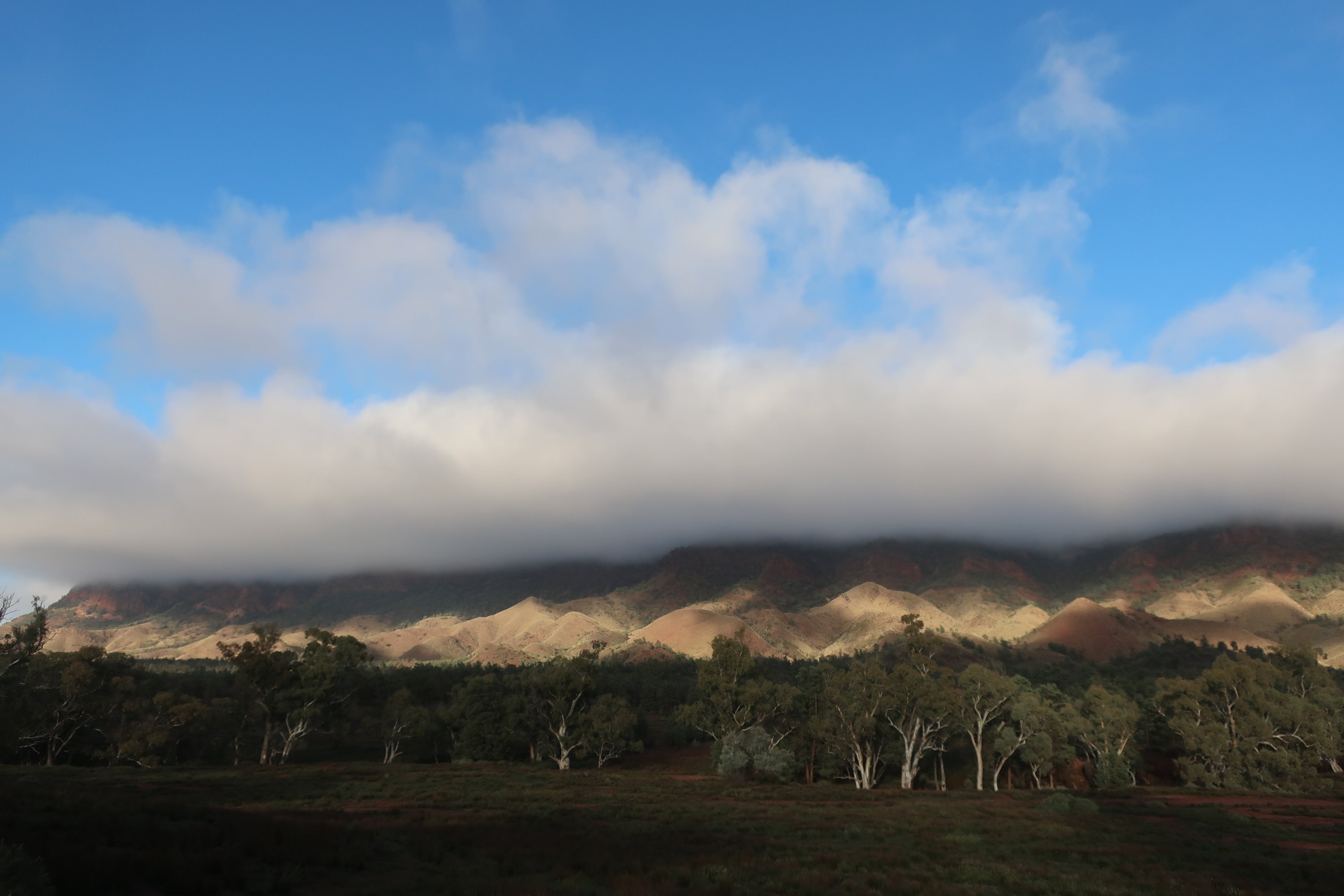

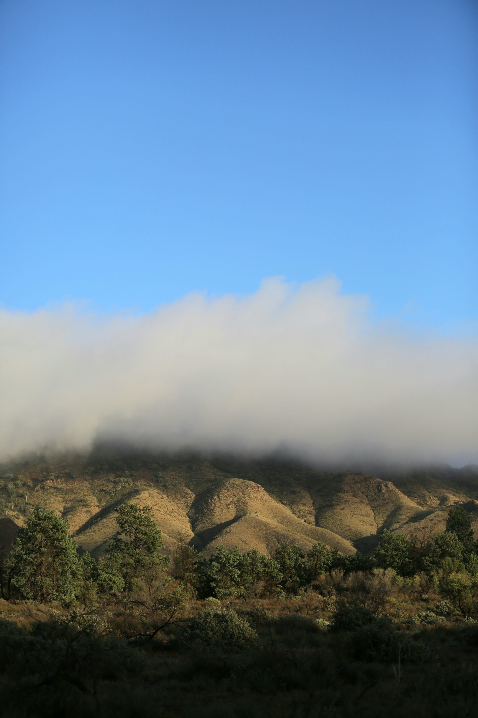
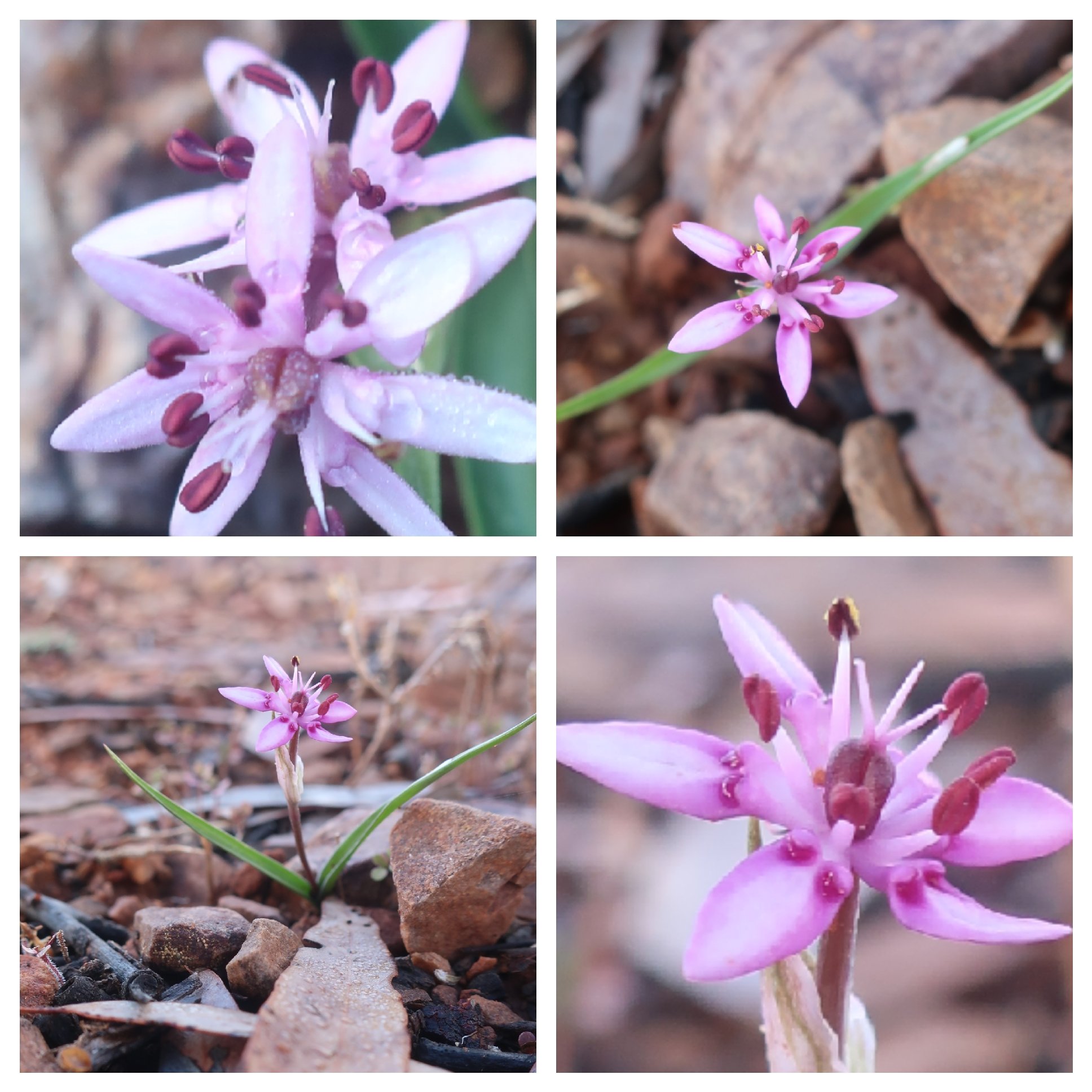
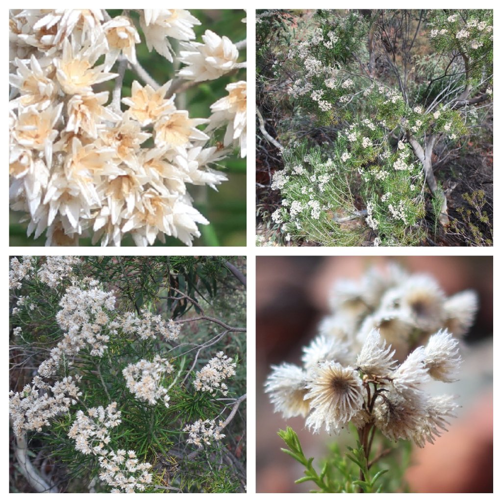
After breakfast we drove a short distance to the end of Aroona Valley, the location of a colonial homestead famous for hosting Hans Heysen, a respected South Australian painter. He spent much of his career painting the Flinders Ranges. From a hill backing the homestead we had stunning views of the Hayward Range to our right and the ABC range to our left. The mountains were shrouded in mist, only the tops were sticking out of the fog and into the bright sunshine. It was such a calm and serene landscape in these conditions. We walked a little way along the Heysen Trail stopping to take in the views and prolific trailside flora.

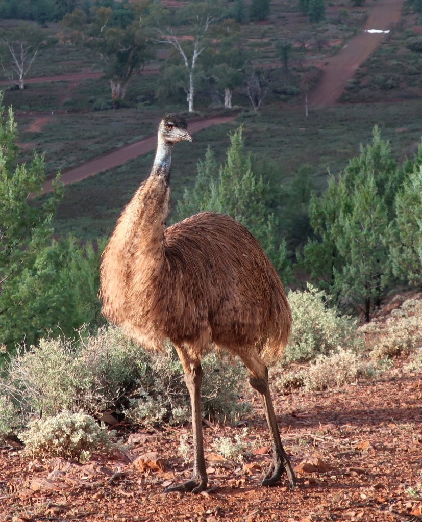
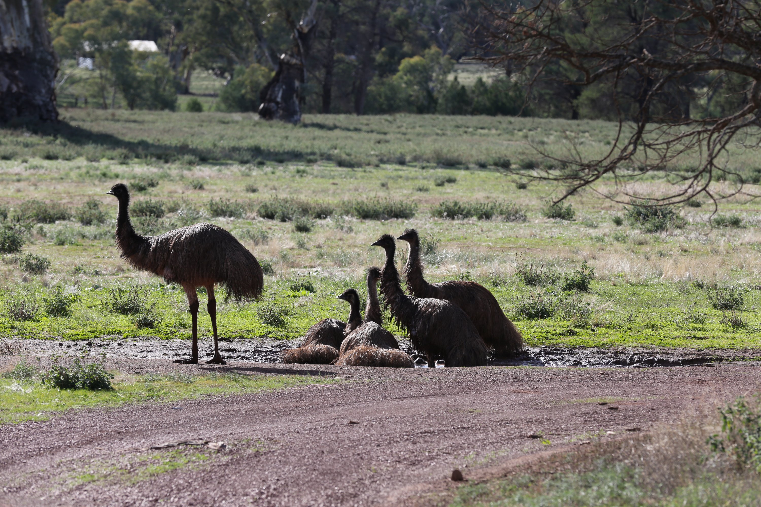
While crouching to take a photo of a flower I was startled to find an emu standing not far from me. It looked keen to have its photo taken. I guess it didn’t know that I’ve been blocked on Instagram.
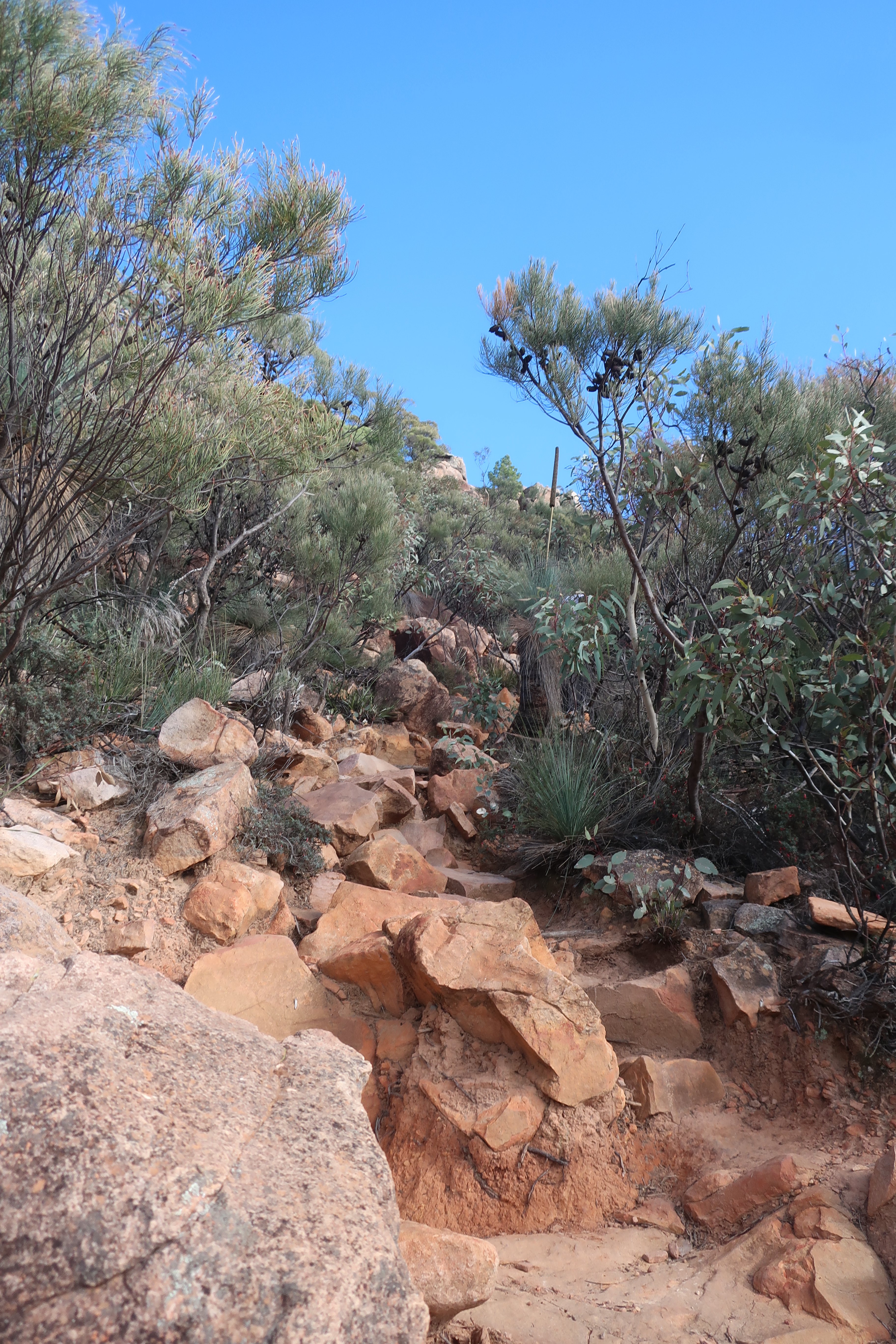
We left the valley to drive the rest of Branchina Gorge. We drove through the first part yesterday, to get to our campsite.
From here our morning got even better. Branchina Gorge is a slice through 100 million years of geological history.
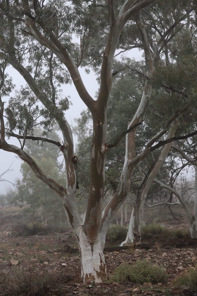
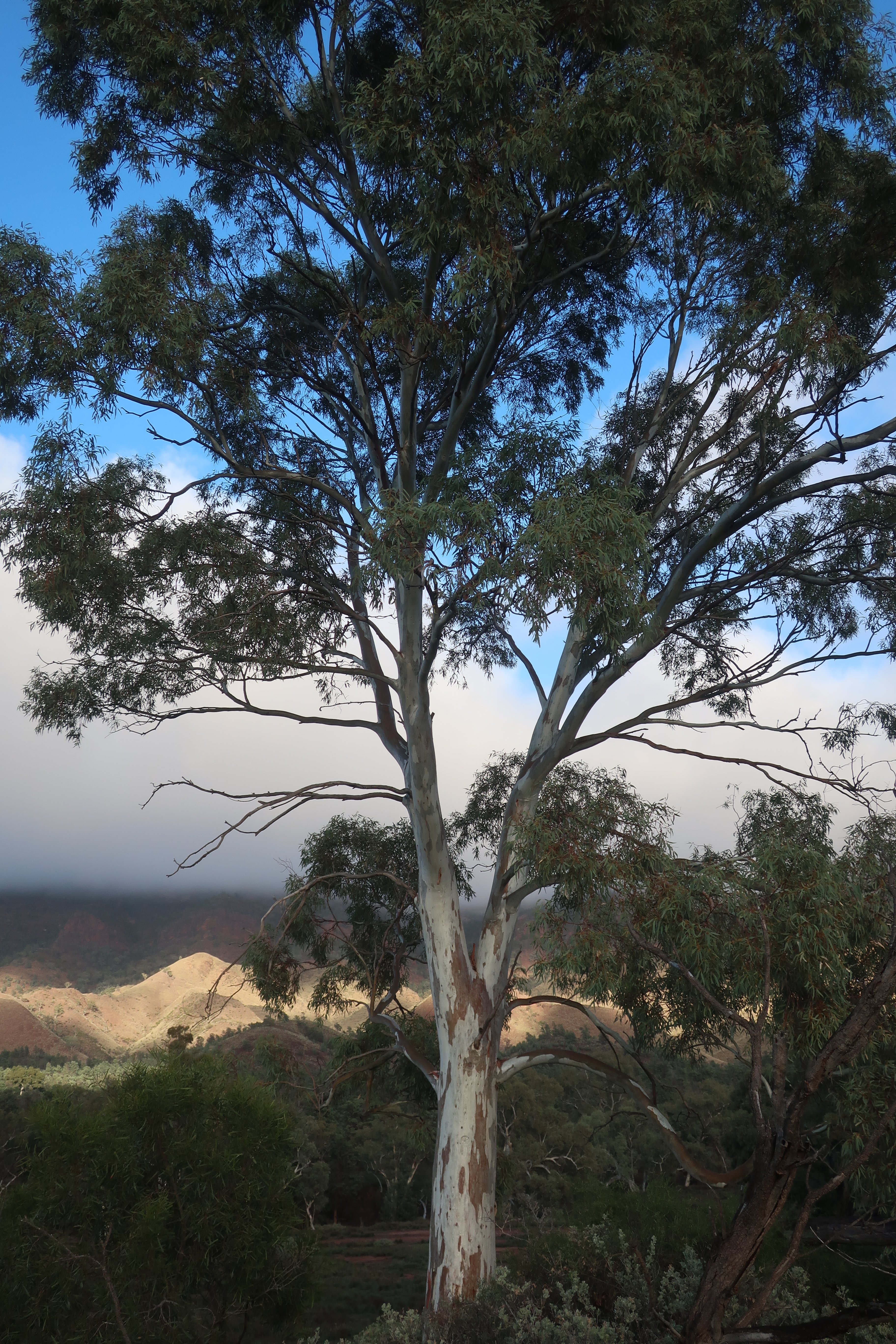
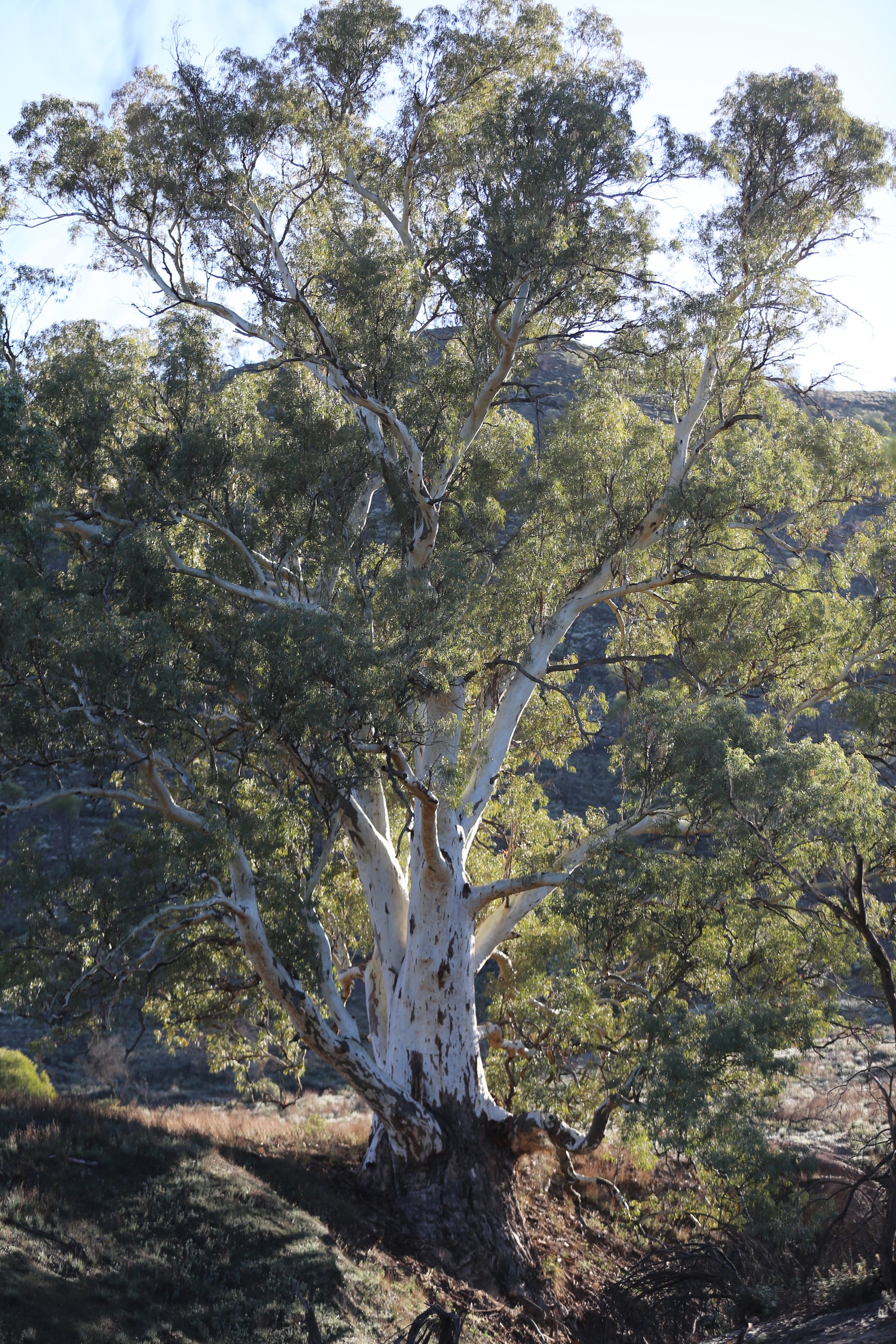
A corridor through time, Brachina Gorge cuts through rock formations laid down between 500 and 600 million years ago. It is peaceful and gum-lined, framed by rugged rock formations. We marvelled at the forces that shaped this landscape. The magnificent giant river gums, their silver trunks glistening in the morning sun, were incredibly beautiful.

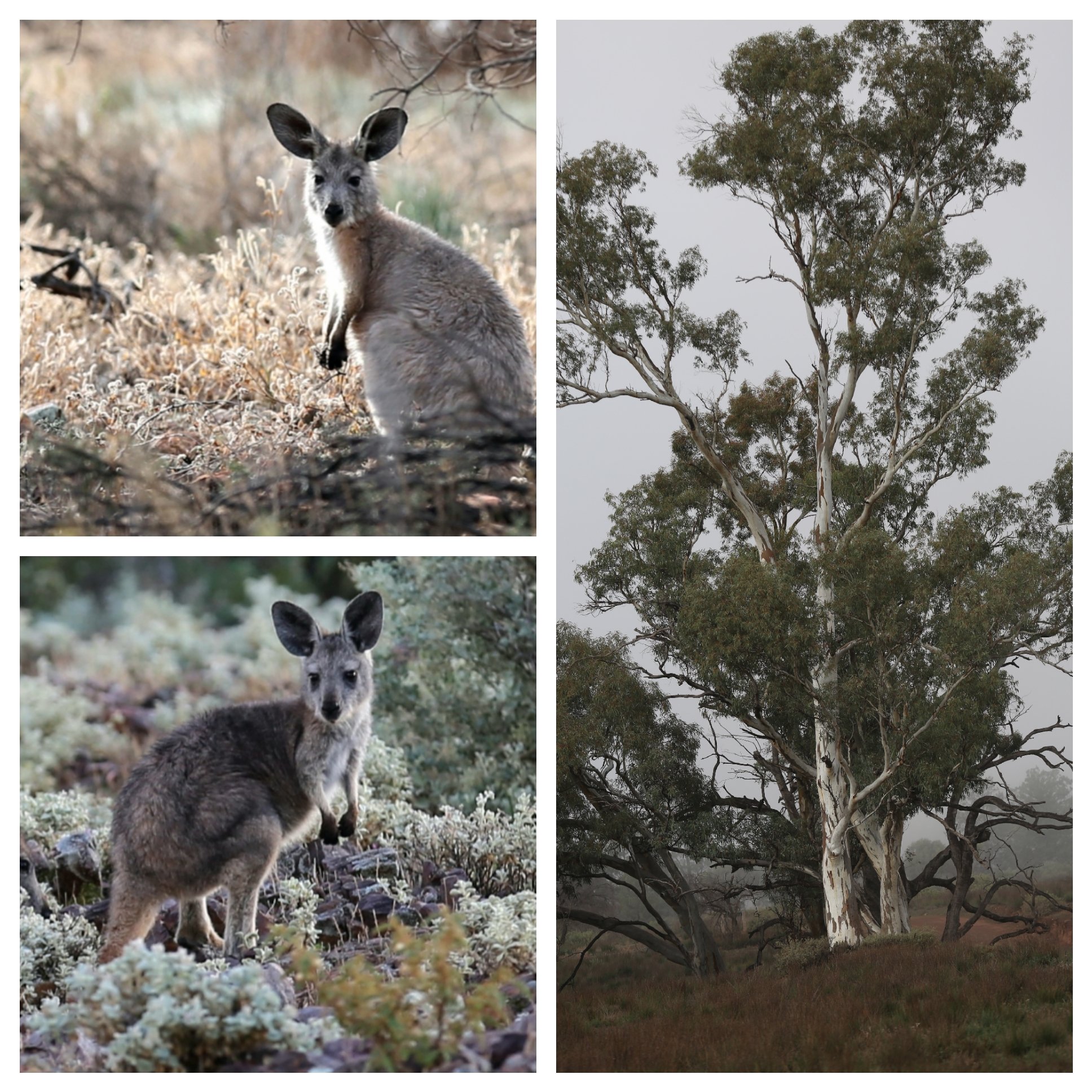
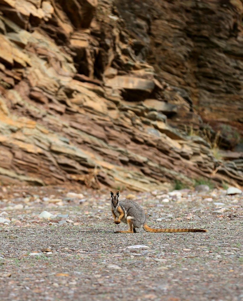
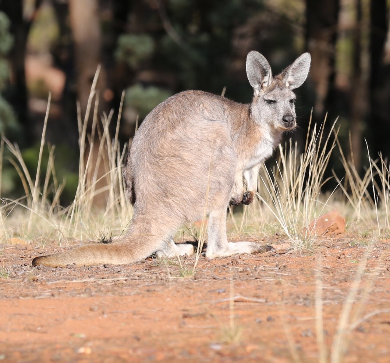
While looking at a wall of folder rock strata we were thrilled to spot a couple of Yellow- footed Rock-wallabies on the river floor and soon after another two on the crest of a hill. These wallabies were hunted almost to extinction by the early pastoralists and fur traders. They are now protected and populations are slowly increasing although they are still listed as rare and endangered.

What a great start to our Flinders Ranges visit. We left the gorge feeling like winners and drove north towards Parachilna and then Blinman, outside the Park. Both are very small settlements popular with passing caravaners.

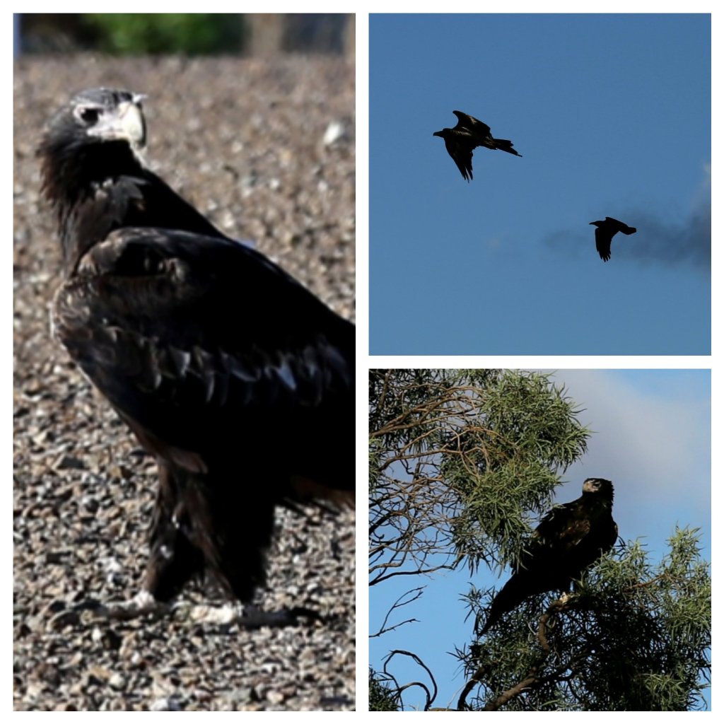
On our way back to camp we stopped a few times to watch eagles and falcons hunting. It was fascinating to have a close up view of an enormous wedge-tailed eagle feeding on roadkill. They look so powerful and fearsome but are very slow to take off. As a result they are also sometimes victims to passing vehicles.
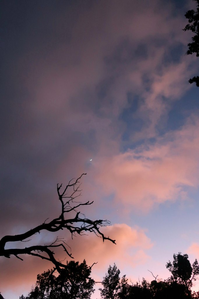
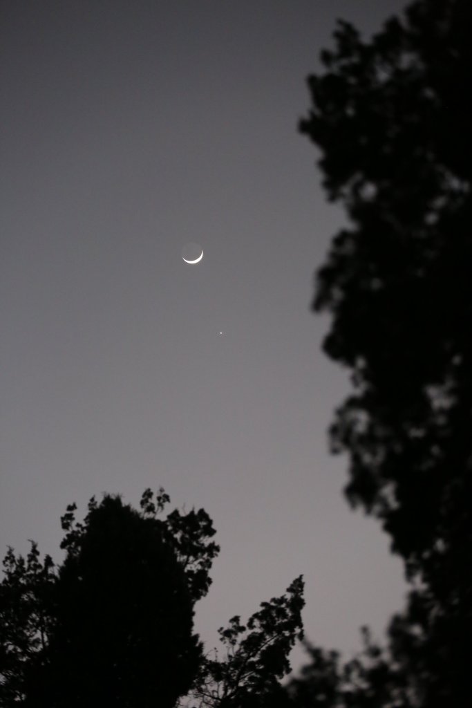
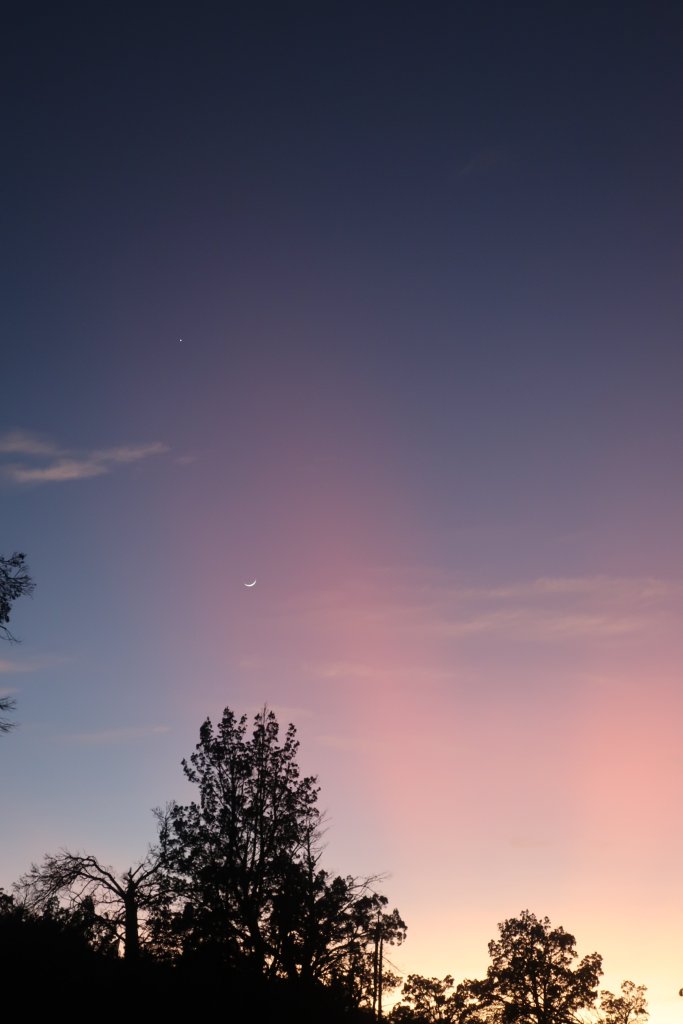
We had a peaceful evening back at camp watching stars fill the darkening sky.

Friday – May 26th, Day 32
We woke the next morning to frost on the ground, it was cold, freezing cold. So we didn’t dilly-dally around camp.
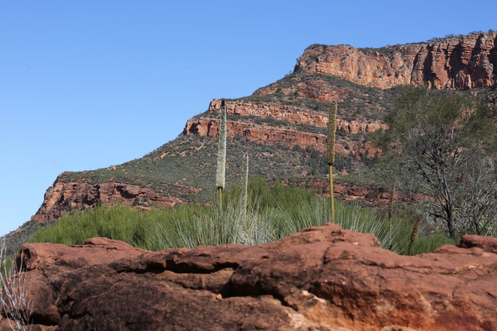
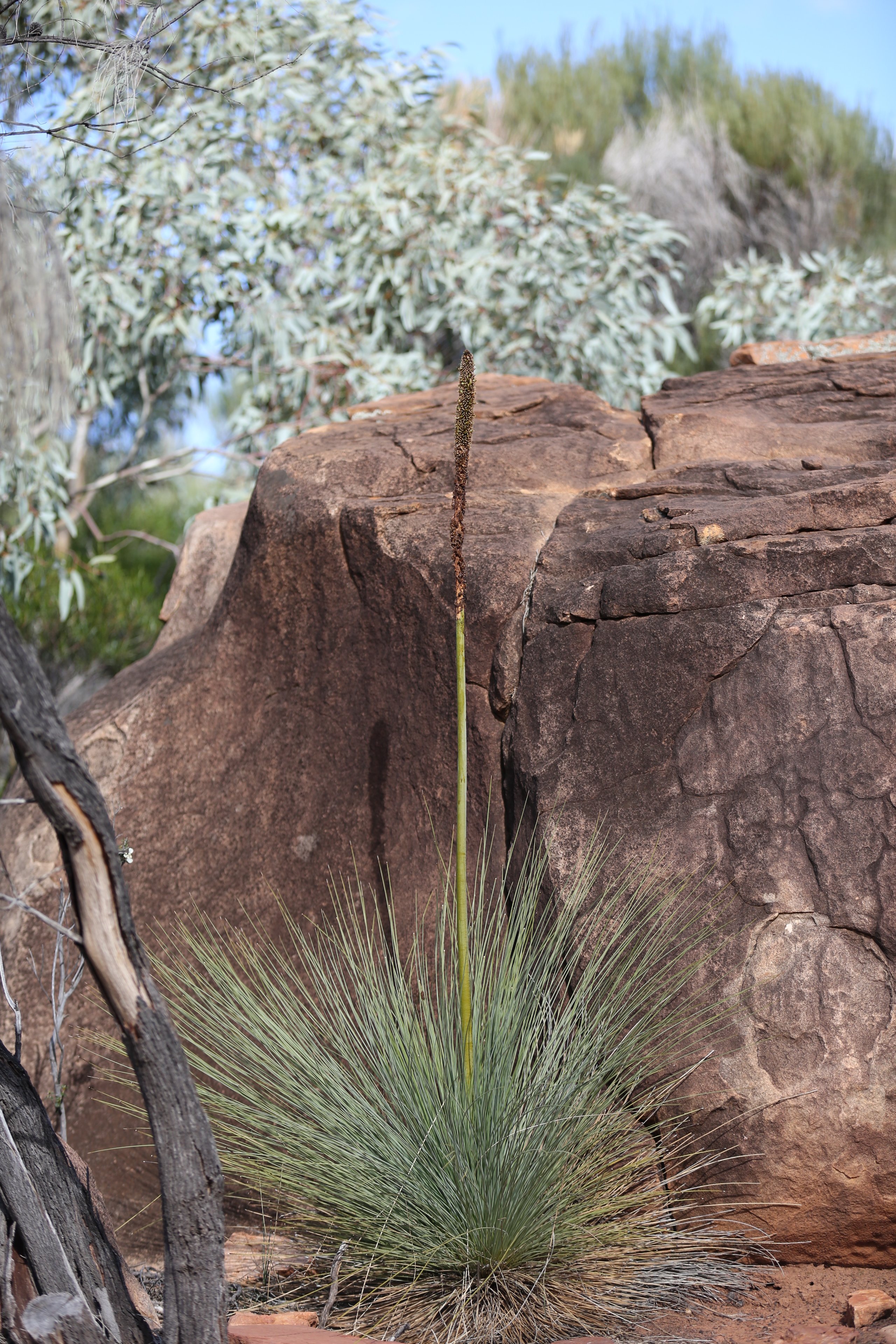
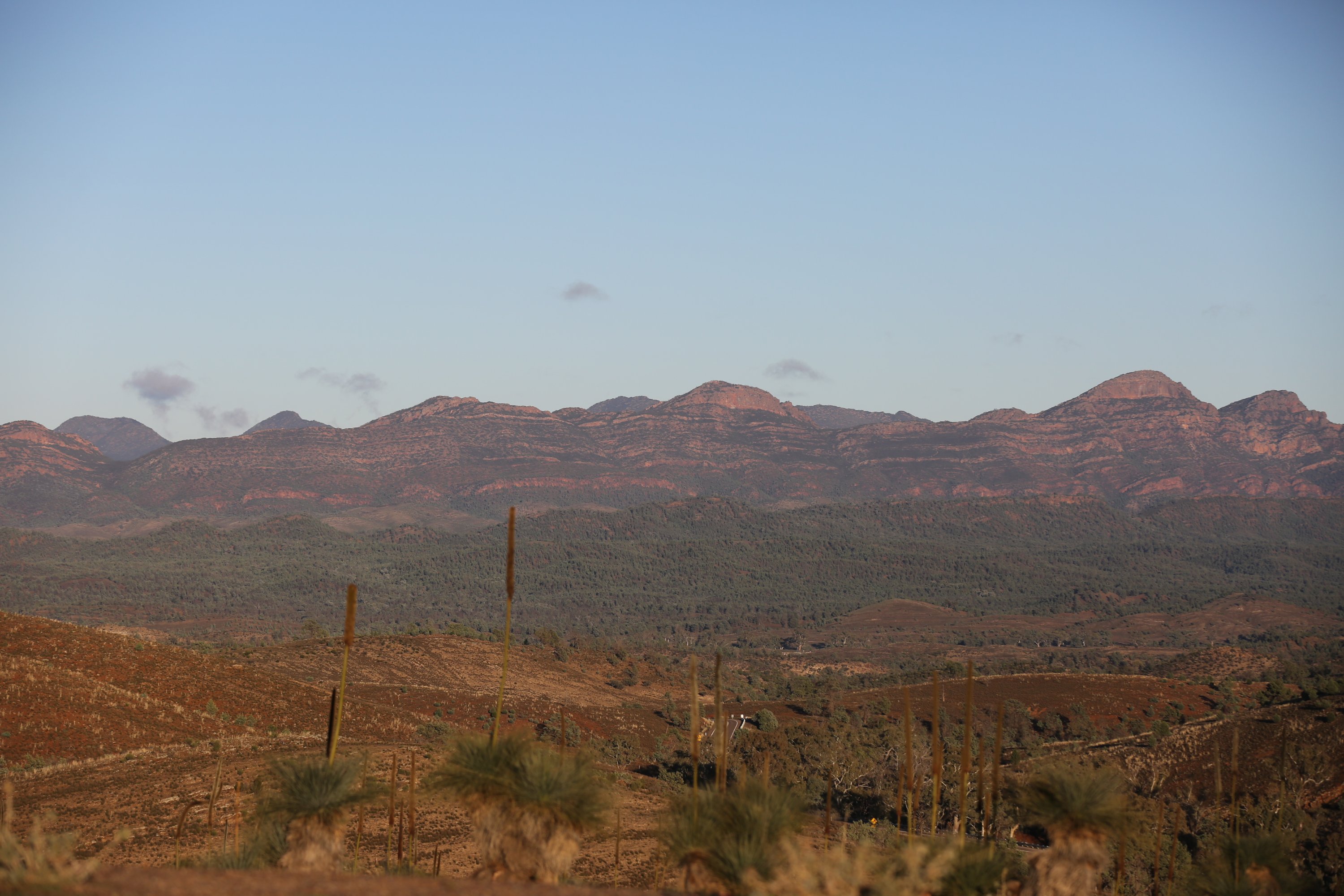
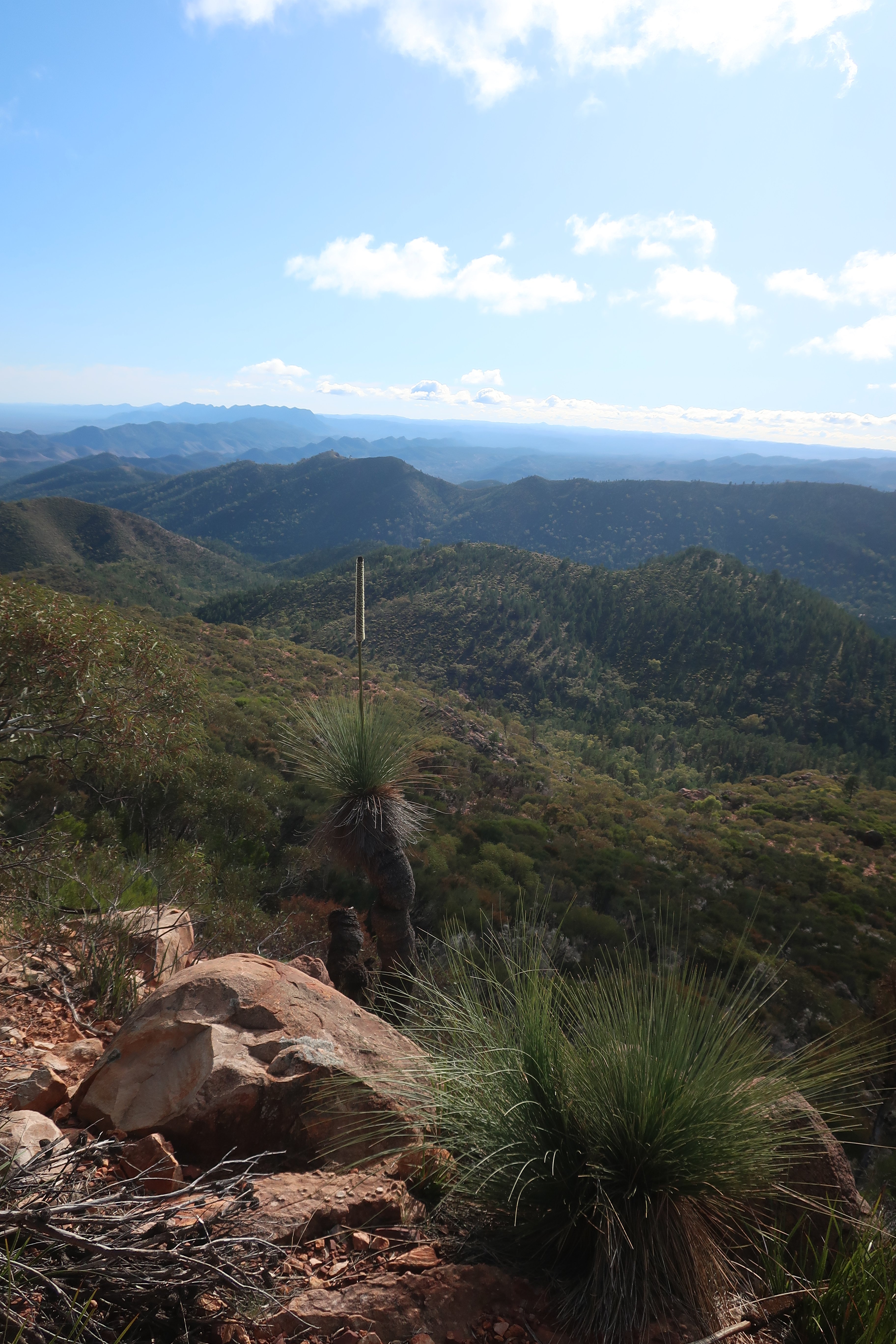
Today we visited Bunyeroo Gorge, another spectacular traverse through the range. The gorge was narrow in parts and winding on rough terrain, crossing several creeks. The scenery was beautiful with giant river gums and ghost gums along the creek beds and views to Wilpena Pound. We stopped at several lookouts that had stunning views east and west through the range. Most notable was Razorback, which has fabulous views of the jagged mountain mountains lit by the morning light.


A short distance from Wilpena Pound is Arkaroo Rock, which has Adnyamathanha rock paintings featuring ochre and charcoal images. The paintings which are remarkably well preserved tell the creation story of Wilpena Pound.


Late afternoon we had a look around Wilpena Pound Resort. It offers a range of accomodation options which all looked very nice. We had a late lunch in the restaurant and charged some batteries before heading back to camp.

Saturday – May 28th, Day 33
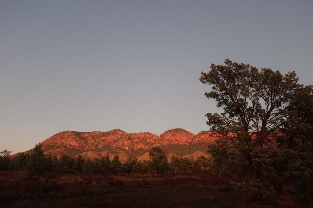
We returned to Wilpena Pound the next day to walk to St Mary’s peak (1171m above sea level). The mountain is central to the Adnyamathanha creation story. For this reason the Adnyamathanha people would prefer that visitors do not climb to the summit of the peak. The day dawned to a brilliant clear sky. The sunrise illuminated the Hayward mountain range, nearest to our camp. Like yesterday, the morning was freezing cold. The thermometer was registering 3°C.

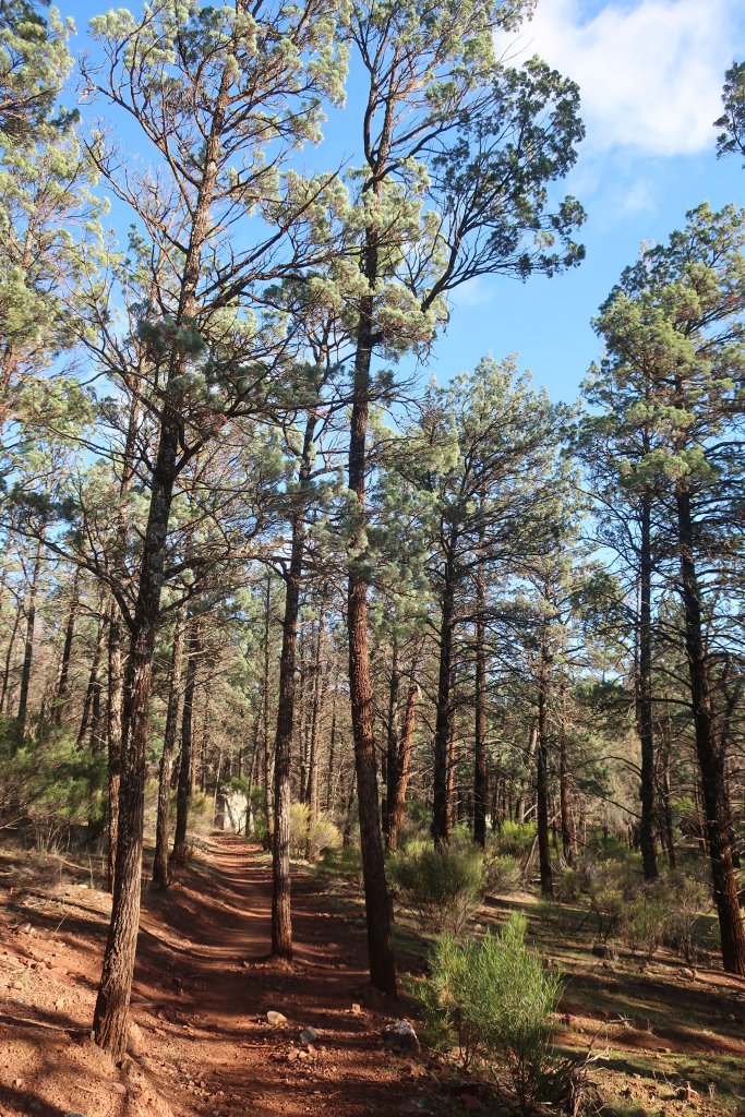
The hike to St Mary’s Peak starts at Wilpena Pound visitors centre. Walking through a pine filled valley was a bit disorintating. We thought we were in the northern hemisphere. The pines look like they may have been planted by the European settlers, but as we traveled through the Ranges we realised that they must be native as there were far too many stands throughout. We later learnt that they are White Cyprus pines, native to the area.
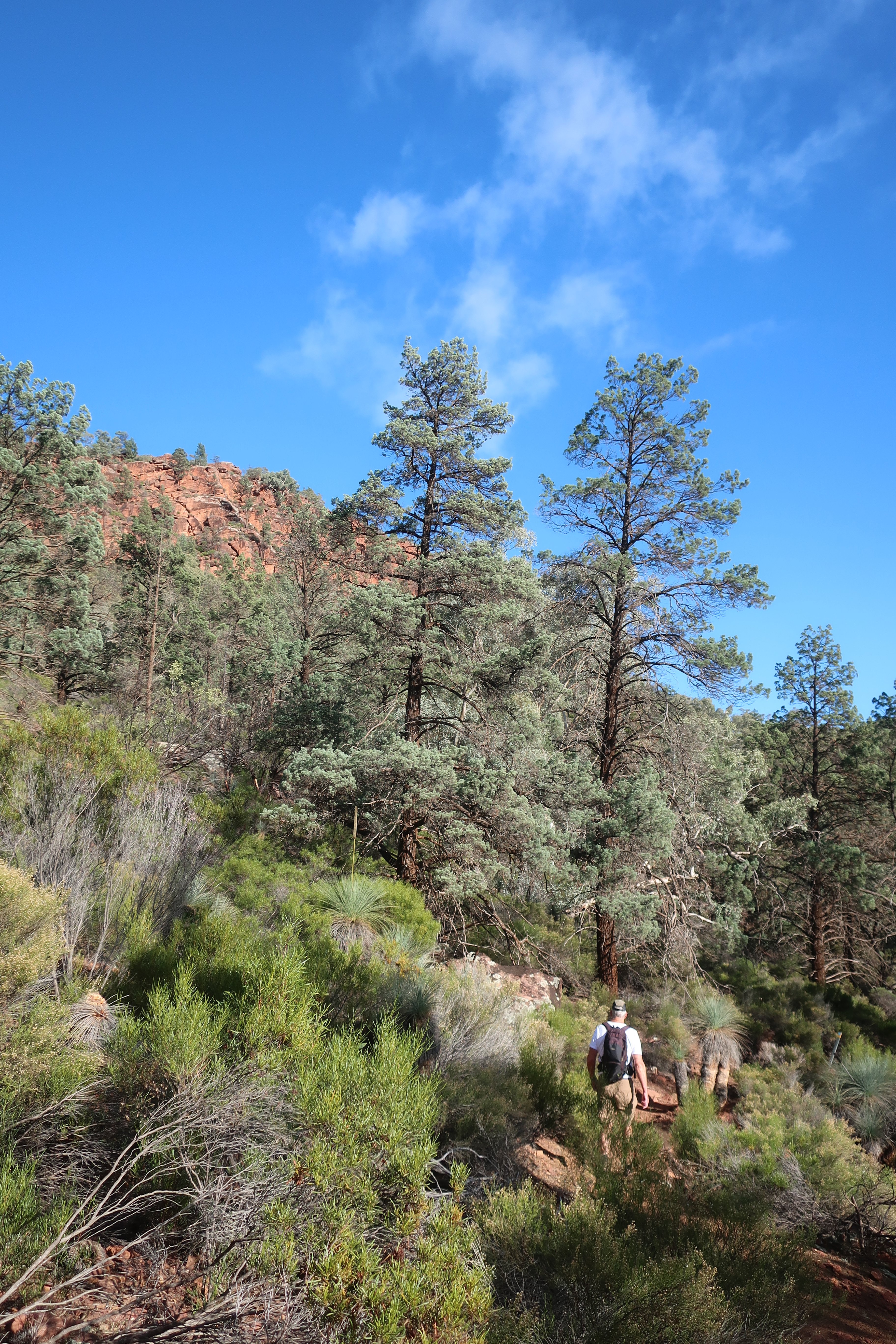
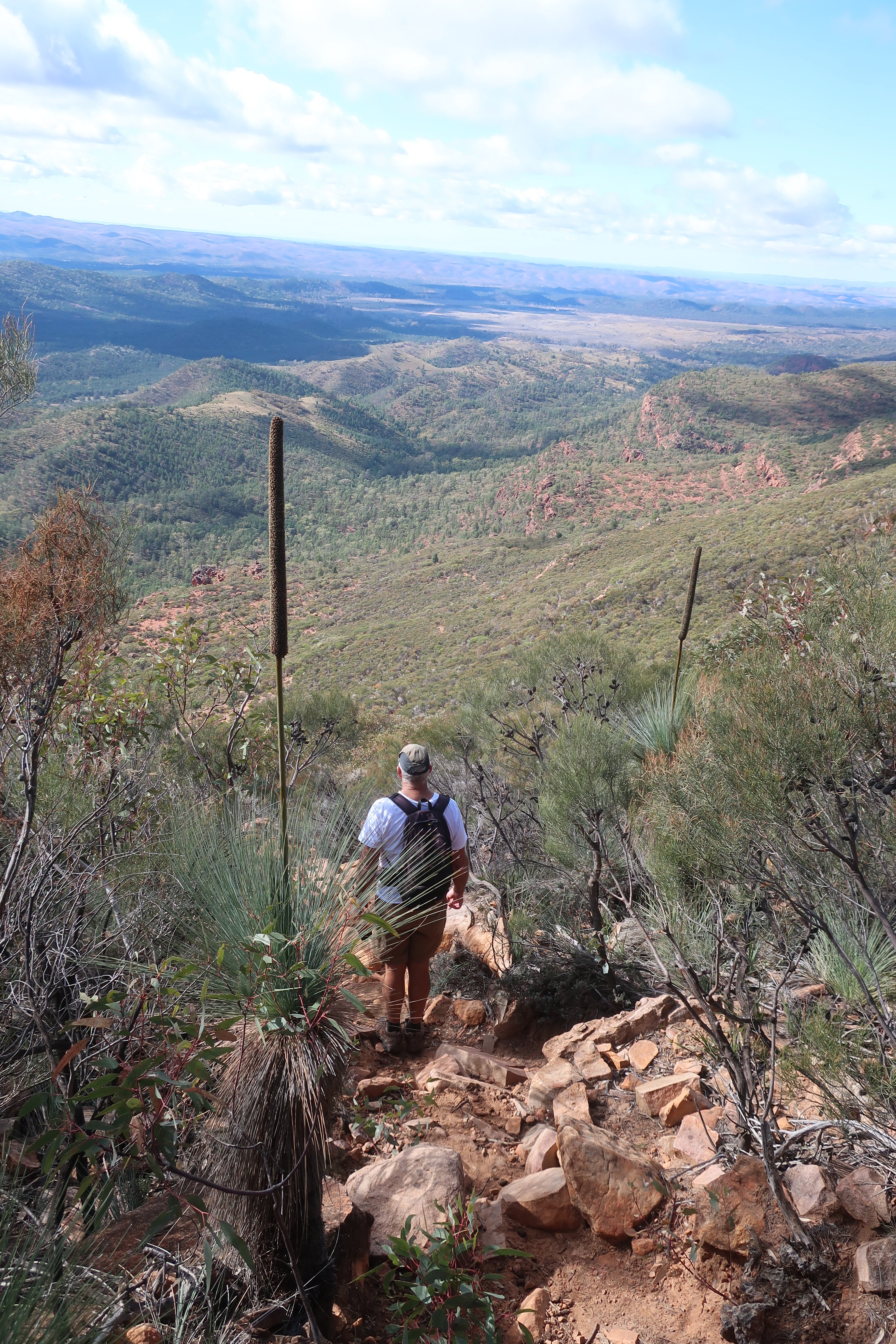
It didn’t take too long before we started to climb and fabulous views of the pound started to open up. An occassional bleating of goats could be heard. The kids made a most unusual sound, almost like a child crying. The last few kilometres of the hike were a scramble, something that always makes me feel nervous on steep slopes. Hammer was climbing like a goat and soon left me behind. It was only my quite crying, like a kid that made him turn around to see if I was OK. That last bit is not really true but he did get a bit carried away scurrying to get to the top.
We had great views from the saddle before the final climb to the top of the peak. We chose to respect the cultural significance of the mountain and did not go to the summit.


My knee felt great on the climb but not so good on the way back down. More work to do on finding out my weak spots.
By the time we made it back to our camp it was too late to do our other planned hike through Aroona Valley. I guess we’ll just have to come back again.

I don’t know which is better, your pictures or your commentary. Enjoying your journey from a distance. Dede and I are getting ready to leave for central and Northern California, Oregon and Washington in July then Victoria, BC for the month of August. Be well.
LikeLike
So lovely to hear from you Joe and Dede. Thank you for your kind words. So good that you’ve kept the Victoria, BC trip active through summer. It sounds lovely. Hope it’s as good as previously. We are yearning for the PCT and with our miserable weather it is awfully tempting.
LikeLike