MOUNT KILLINGTON
AT Day 131: Wednesday, August 16, 2023
SOBO Mile 1720 – 1698.5
Stony Brook Campsite – Sargeant Brook Campsite
Distance Hiked – 21.5 miles/ 34.6 km
Total Distance Hiked: 2157.5 miles/3471.5 km
A:5699 ft/1738 m D: 5144 ft/1569 m
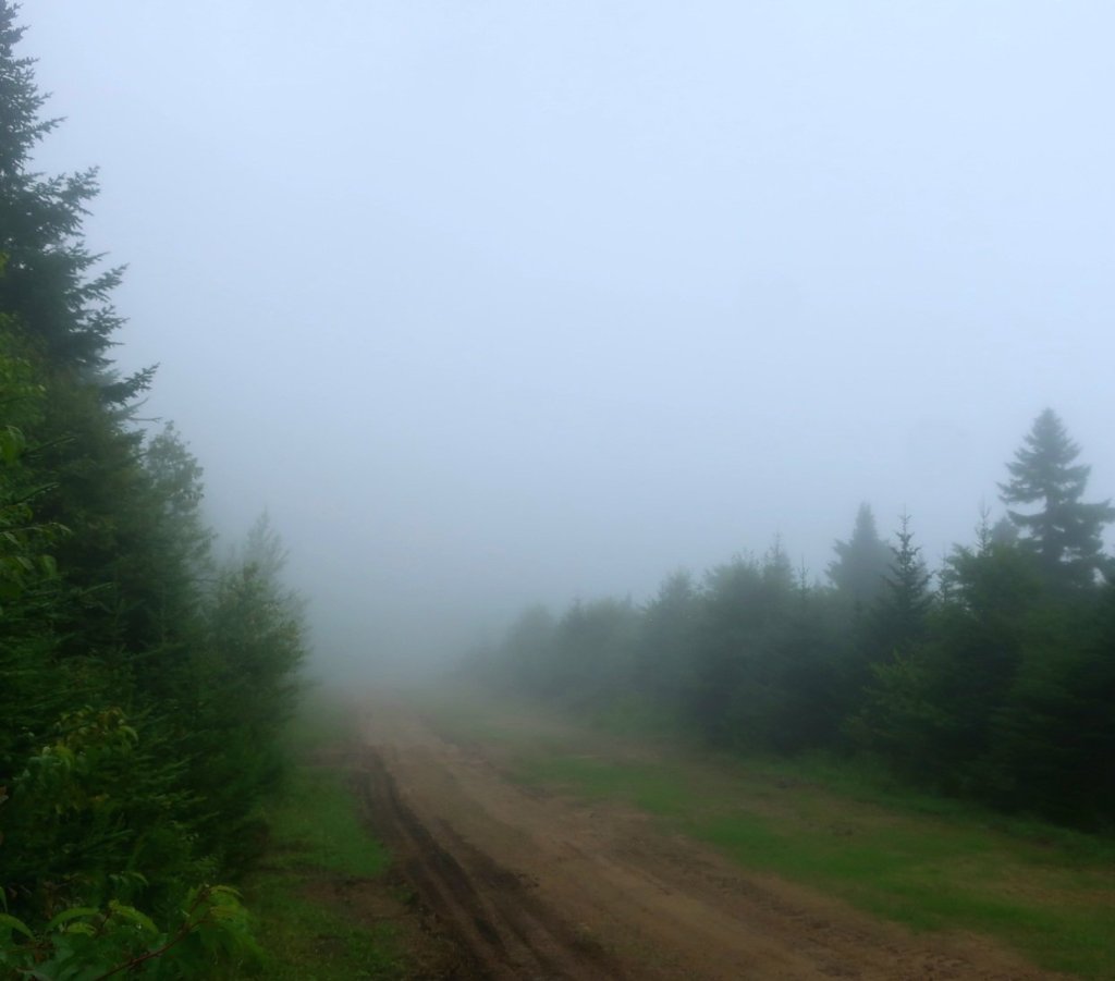
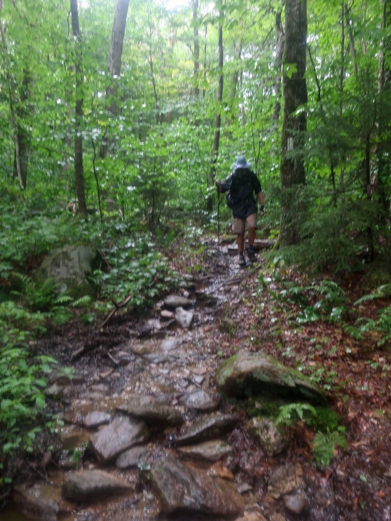
We slept well on our campsite by Stony Brook. It didn’t rain through the night just residual moisture on the leaves dripping on the tent. I was awake way too early. keen to get going, keen to get one day closer to getting it done. For a long time now our focus has been on just finishing. Maybe we are just too stubborn to quit So after my morning coffee and breakfast biscuits for Hammer we broke camp before the rain arrived and were on our way at 5:30. From Stony Brook it was a long ascent up towards Quimby Mountain. The air was misty in between the trees and the trees were dripping water. The dripping moisture soon turned to rain.

From the summit we had a long descent on reasonably good trail down to River Rd, one of the roads leading to Killington. I was dreaming of escape. We had cell service so I checked the weather. The rain should stop and won’t return till late afternoon. We were happy to see that we should have quite a few hours of relatively dry hiking. And soon after reading this the sky opened and quite heavy rain set in. So much for weather prediction.
We took Sherburn Pass trail off the AT to get to the Inn of the Long Trail for lunch. Sherburn Pass trail is an old AT route. We got to the Inn just as they were about to open for lunch at 11.30. It was wet and miserable outside and the the hotel was so cozy inside. Lots of timber work and Irish pub downstairs. I so intensely wanted all it’s comforts and not have to go back outside. We had to wait for 10 minutes before they started serving lunch.
We ordered our lunch and checking my emails I found an invitation to enter next year’s Tokyo Marathon. Tokyo Marathon is the last of the world marathon majors for me. It is the hardest world majors marathon to gain an entry to as they favour local runners. . I spent the full hour trying to register instead of eating my lunch. Hammer helped me to finish the chips. I keep forgetting the distinction between chips and fries here and am always disappointed to get chips when I expected fries.


By the time we left the Inn the difference outside was quite stark. While not quite sunny the rain had stopped. Everything looked a little bit brighter. Much more pleasant hiking conditions for the afternoon, we hoped. Several hikers tents were set up across the road from the Inn. It looked like they were absolutely saturated and obviously no one’s out hiking just staying out till the weather improves.
It days like today that make me wonder why the heck we doing this. We don’t see anything just hiking through dark woods, through mud and rain just so we can finished what we started.
We followed the old AT route, the SherbourneTrail till we rejoined the AT. The promised views from Pico mountain were fogged in. As we rose up the mountain away from the road the mist closed in around us and the rain returned. It didn’t take long, we had half an hour of rain free hiking.
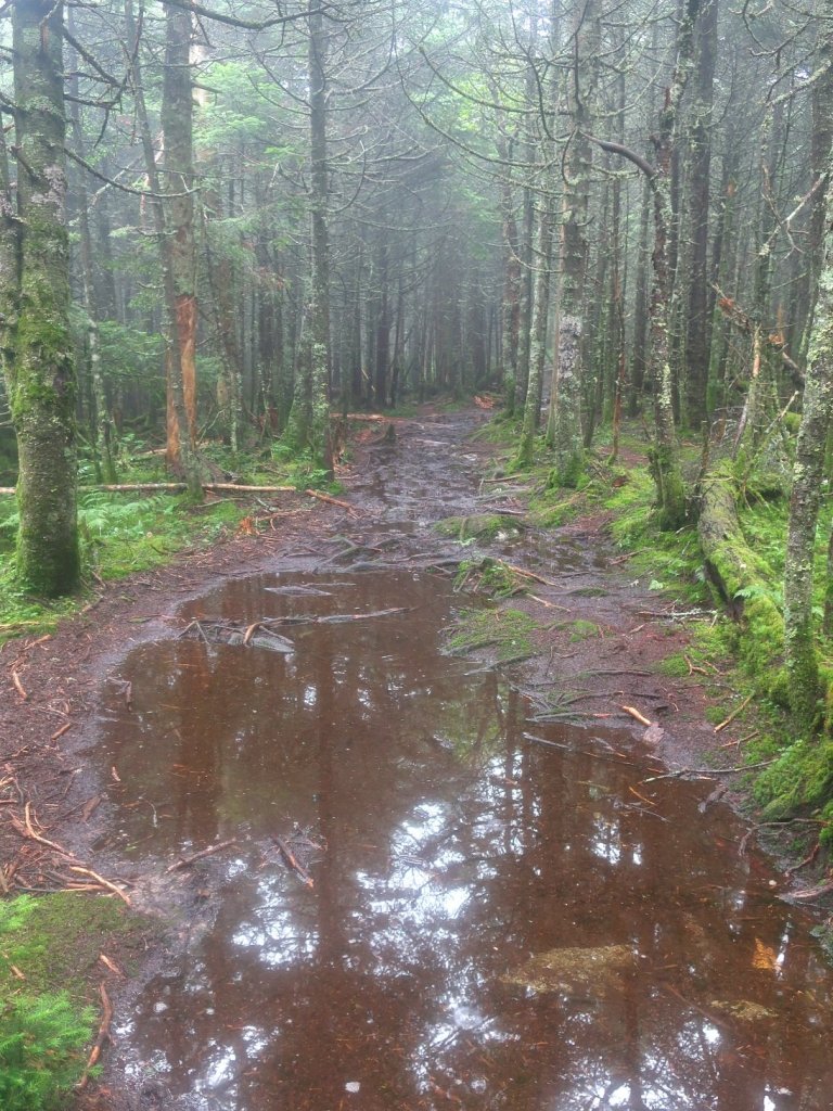
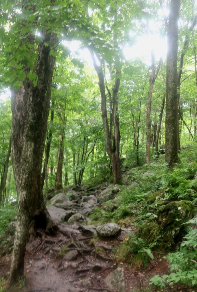
The rain stopped and started as we ascended Mount Killington. It was only two miles but it just seemed to go on and on. We were back on rocks and roots and much more mud then we’d had so far in Vermont. The rocks and roots combined with wet weather and mud made for very slow progress. It was almost 4:00 p.m. when we made the summit, well not really the summit. The AT passes on the non ski field side of of Mt Killington. The summit is a spur trail off the AT.


As there was nothing to see we started our descent of Mt Killington. In the brief periods when the rain stopped, flashes of sunlight teased us. It illuminated the wet vegetation giving everything a luminous quality and quite beautiful for a short while. By the time we started the descent, clouds closed in again and rain threatened by continuing to drizzle and intensifying every now and then. The woods looked dark and dank and we were really quiet in the Grimm Brothers fairy tale.

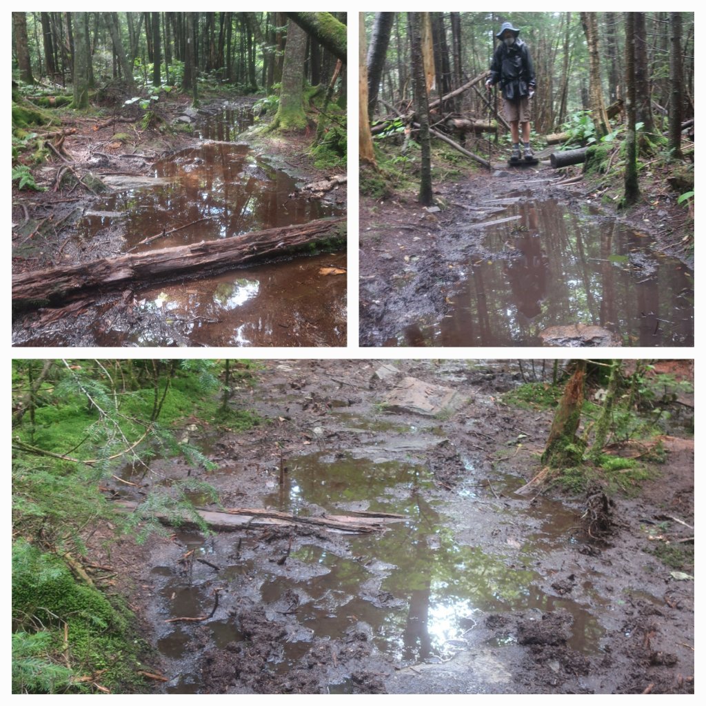
We were less then a mile into the descent when heavy rain set in. It rained for an hour and the sun came out soon after. The descent off Mt Killington took us almost 3 hours. It felt painfully slow especially as I’ve started to develop blisters. Almost the same pattern as on our early days in Vermont back in early July. I think the soil is very sandy and with the unavoidable sections of mud the sand that gets inside my shoes behaves like sandpaper on my feet. I’m also wearing Injinji sock liners and this is holding the wet sand against the skin. The double sock combination has kept my feet largely blister free on all our previous hikes, but not in Vermont. Hammers shoes being leather didn’t have so many problems.
It was getting dark when we made it to Governor Clements shelter at the base of Mt Killington. We found a campsite by the nearby Sergeants Brook and were very relieved to stop for the day.
Wonderful news about Tokyo! As for the rest, I have no words except that old carrot…..NEARLY THERE.
LikeLike
We just had to accept the weather if we wanted to finish. I don’t know how people can sit in a shelter all day waiting for the rain to pass.
LikeLike
Congratulations on the Tokyo marathon! What an honor. I hope your poor feet recovery quickly. The trail looks really difficult with all that uneven terrain. I’m so glad you stop to take photos of all the beautiful flora and fauna along the way, and i hope that gives you a bit of joy since the views haven’t been very spectacular due to the fog and rain.
LikeLike
Thank you, Tokyo will be my last marathon. It’s been tough on the AT to find the joy at times. It was good when the beautiful fungi replaced the flora. And the Red Efts felt like our wet weather friends. Lifted my spirits to see them on otherwise miserable days.
LikeLike