CARRABASET VALLEY VIEWS
AT Day 112: Friday, July 28, 2023
SOBO Mile 2010 – 1991
Route 27 Stratton – Sluice Brook Logging Road Campsite
Distance Hiked – 19 miles/30.6 km
Total Distance Hiked:1866 miles/3002 km
A: 5875 ft /1792 m D: 5656ft/1725 m
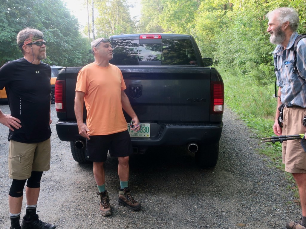
Feeling rested we left the motel to hitch the 8 miles back to the trail. It didn’t take long before we got a ride with Osher and his friend who is finishing the AT northbound this season. What an amazing feeling that is for NOBOs, one last big mountain range, a few hills and then onto Mt Kathadin. We still have quite a few mountains to climb before we finish.
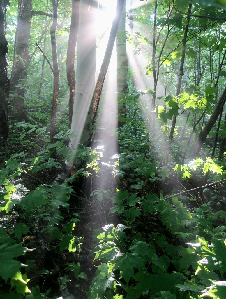
Todays hike started with a 5 mile climb up Crocker Mountain summit. The trail up to Crocker Mt was in reasonably good condition, only a few rough patches. The morning had started cool but by the time we were half way up the climb sweat was beading on my skin and clothes were soaked in sweat. It was humid, surprisingly warm and humid. It was wonderful to see shafts of sunlight burning through the mist in the air as we neared the top. Crocker Mt is another 4,000 foot summit.
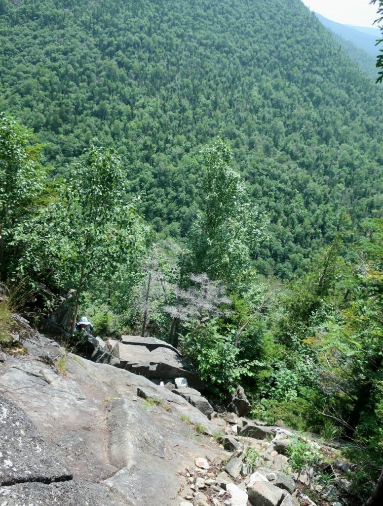
The summit of North Crocker Mt had no views, it was covered in trees. From there we descended and then climbed up towards the South Peak of Crocker Mt which had slightly better views. The descent of the South Crocker Peak was really steep, almost vertical in parts and very slow going. My knee was painful on the descent.
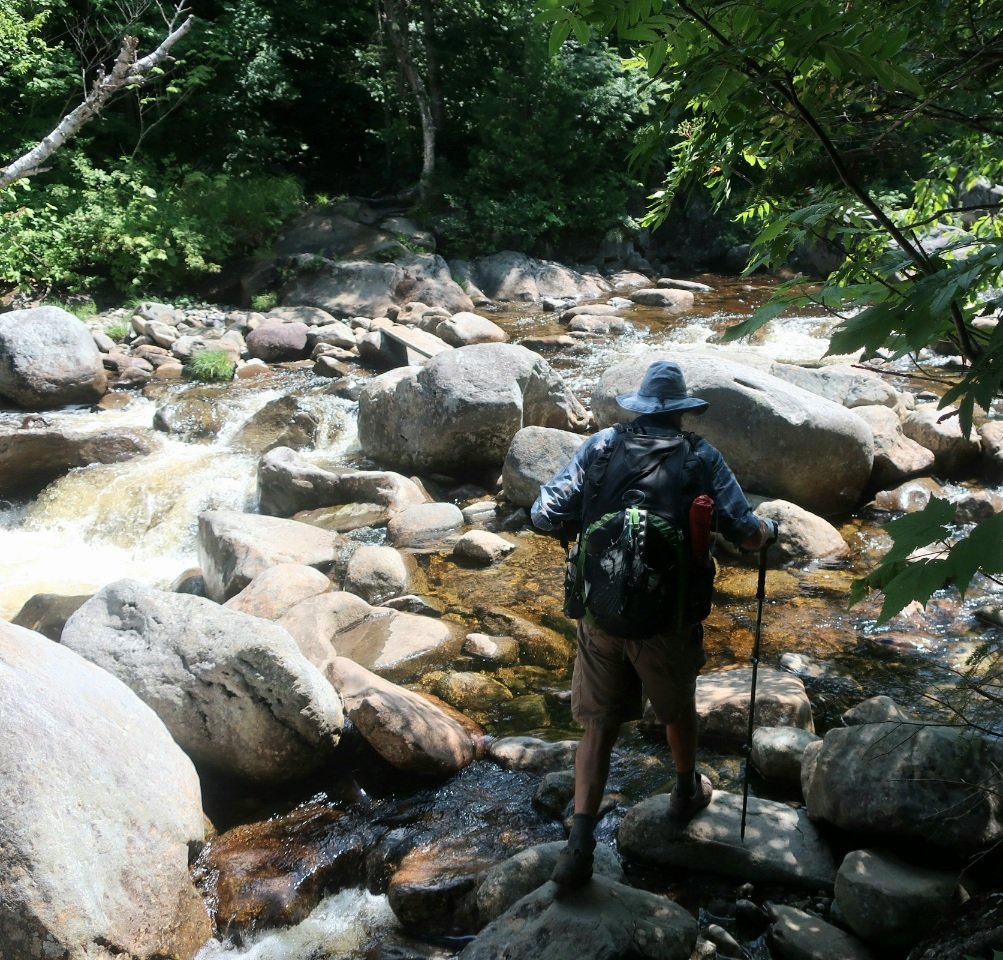
We stopped for lunch just before the Carrabasat River crossing. The river was flowing swiftly and we were grateful for a timber board placed on a couple of boulders so we could cross and keep our feet dry.
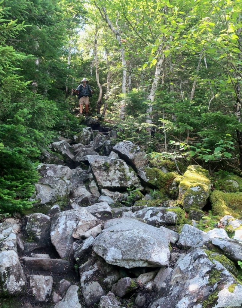
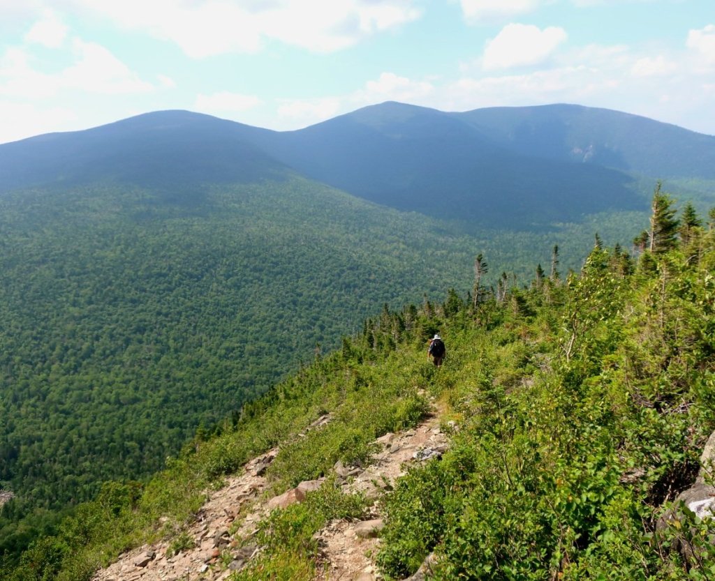
From the river it was a steep rocky climb up to towards Spaulding Mt. A side trail leads to the summit of nearby Sugarloaf Mountain which has a ski field. Almost near the summit we had great views of the Carrabaset River valley and the impressive mountains surrounding it.


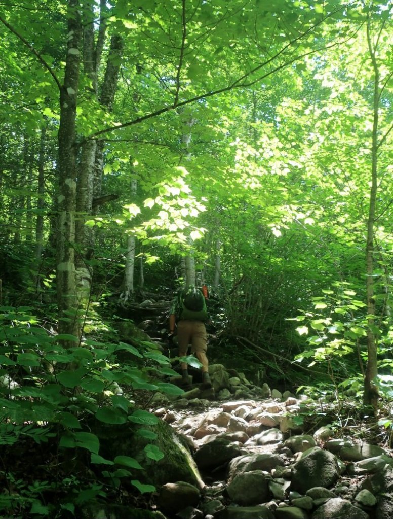
From the summit of Spaulding Mt the trail was really nice. Despite tiring in the late afternoon it was quite enjoyable to hike on a soft, well formed trail for a bit. The nice trail ended at Lone Mountain, at the end of the mountain ridge. From here we descended for a few miles on wet and boggy trail till we reached an old disused logging road where we stopped for the day.

My knee was a bit sore towards the end of the day especially when Hammer set a cracking pace to get us to a campsite by 7.30pm.
whoops, catching up, you’re past Long Pond…
LikeLike
👌
LikeLike
Glad to see you two are still out there! And you’re knee is holding up too! If you pass a fellow NOBO around Long Pond he may be my college friend, trail name Buck. Told him to look out for you and say hello as he passed.
LikeLike
Hope Buck finished OK. It’s possible our paths crossed.
LikeLike
Some of those rocks and boulders look mighty slippery. Take care.
LikeLike
Rocks were very slippery whe when. Maine not as bad as New Hempshire and Vermont. But it could be that we had better weather in Maine.
LikeLike